Snow in Boston area again? Weather forecast maps show 2 chances for light accumulation.
The weather forecast in the Boston area is calling for more snow today, two days after the Blizzard of 2026.
This will be a minor event, essentially just about a 4-to-6 hour period of light to moderate snowfall across Massachusetts Wednesday.
Boston weather today
It started snowing in Worcester County and western Massachusetts around 7 a.m. and in eastern Mass. between 8 and 9 a.m.
Some roads may become snow-covered, especially those that are untreated.
The snow will last through midday and taper off between noon and 2 p.m.
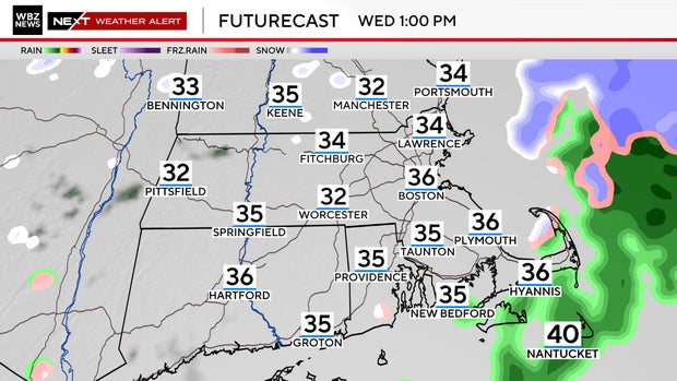
There could be a touch of rain mixing in along the South Coast, Cape Cod and Islands.
Boston snow
This will be a borderline plowable situation.
We are forecasting a coating to one inch in Boston and across eastern Massachusetts and 1-to-2 inches west of Route 495.
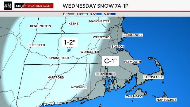
Much of what falls and accumulates will likely melt by the end of the day.
We expect developing sunshine in the afternoon and temperatures in the upper 30s.
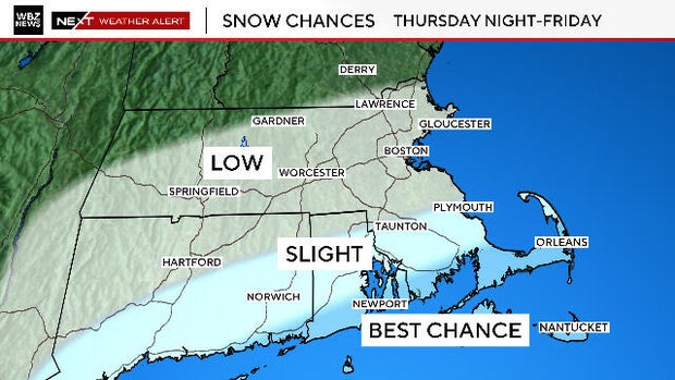
Thursday night snow?
One more "snow note."
There is a slight chance that southernmost New England will get fringed by a storm passing well to our south Thursday night.
Most models are showing a complete miss, but just wanted to put it out there. We will update this forecast as data comes in over the next 24 hours.
If some snow does come ashore, amounts would be very light.
Let's end on a positive note - the forecast for the weekend calls for temperatures to be near 50 degrees on Saturday.