Triple-digit temperatures, heat advisory continues in North Texas before rain chances return

For the second time this year and the second day in a row, DFW hit 100°. We expect it to be even hotter on Thursday.
A slow-moving front is moving in from the north, and it could reach the Red River by late afternoon on Thursday. This creates a small storm chance along the river.
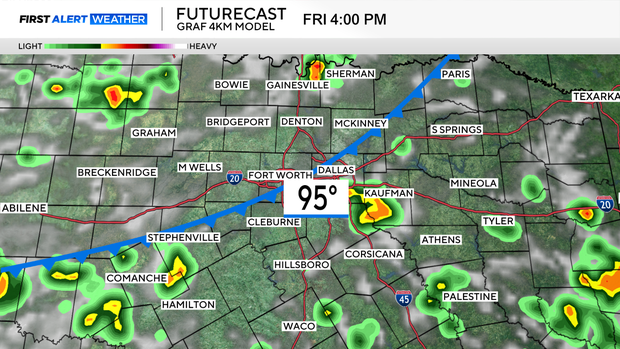
That front comes into North Texas on the first day of August on Friday, triggering storms during the afternoon hours. Some story on Saturday, a 30% chance of afternoon storms and cooler temperatures.
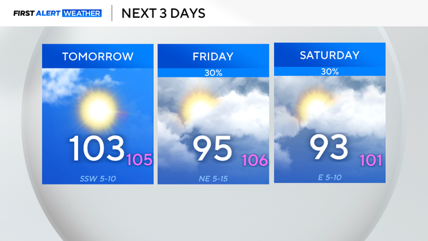
As rare as fronts are in summer, this one arrives dead center of our hottest, driest period (July and August). Just as we turn the calendar, the front gives us meager rain chances and cooler temperatures for the weekend.
These storms could produce damaging winds, so we'll watch them across the afternoon and early evening before they die out.
The rain chances will continue until Monday before high pressure builds back overhead. It'll be till the end of next week before we start talking about 100° days again.