Timeline of Wintry Weather for DFW
Below is a nice timeline showing temperatures and precipitation for the weekend.
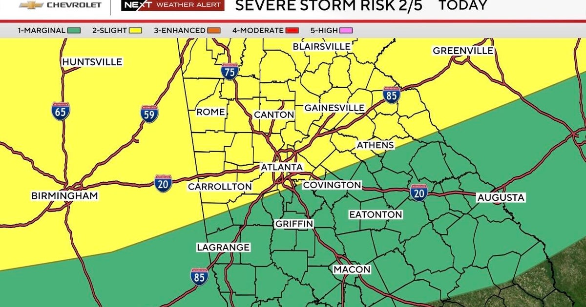
WINTER STORM WATCH
The counties shaded in blue are under a Winter Storm Watch starting at 6am Sunday thru Noon on Monday.
TIMING THE ONSET OF WINTRY WEATHER
The exact start time of when we will see sleet/freezing rain/snow in the DFW area is a little uncertain at this time. Most of the forecast models have been consistent in bringing the wintry mix into the area during the afternoon and evening on Sunday and continuing into Monday.
A few of the models have the precip arriving in the morning on Sunday. At this time, I am more confident in the precipitation arriving in the afternoon and evening on Sunday.
SIGNIFICANT IMPACT POSSIBLE
This could be a high impact winter weather event. Slick roads will be likely Sunday into Monday. There is also the possibility if temperatures are cold enough where power outages could be possible. (SCROLL DOWN)
STAY TUNED TO CBS 11 for updates throughout the weekend.
USEFUL LINKS:
WHAT'S THE DIFFERENCE BETWEEN FREEZING RAIN/SLEET/SNOW
DFW TRAFFIC UPDATES

