Areas south of Pittsburgh could see isolated downpours, gusty thunderstorms Monday | First Alert Weather

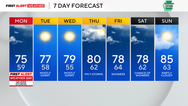
We are waking up on this Monday to models shifting our severe weather threat more northward, so Monday is now a First Alert Weather Day.
Daily average High: 81° Low: 61°
Sunrise: 5:50 a.m. Sunset: 8:54 p.m.
FIRST ALERT: Today, isolated heavy downpours and gusty thunderstorms are possible south this afternoon.
AWARE: Chance of storms returns Thursday.
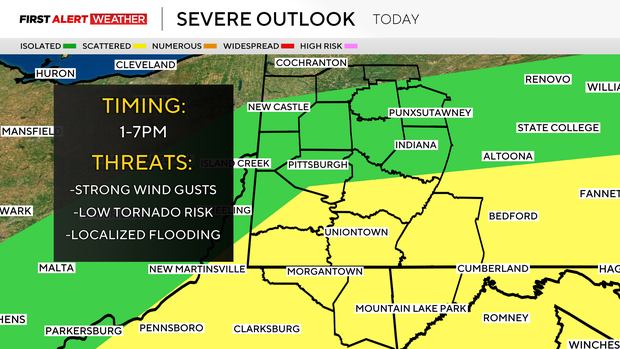
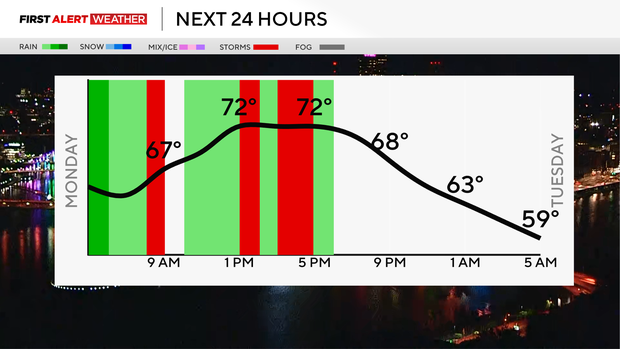
The threat will be south of Pittsburgh this afternoon and evening, ending around 8 p.m. Clouds seem to break apart more into the afternoon, which will add more fuel to the atmosphere for a better chance of storms firing up.
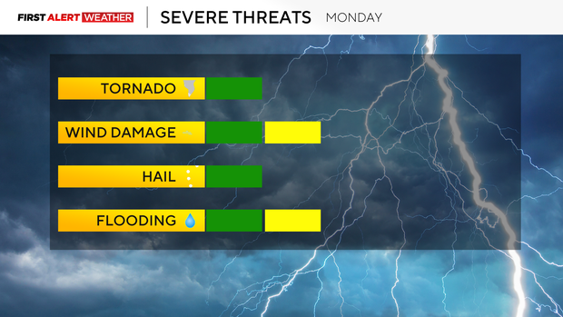
Isolated heavy downpours could lead to localized flooding, and some gusty thunderstorms could cause trees to fall and power outages for some areas south as well.
It's not going to impact everyone, but if you have outdoor plans this afternoon and evening, have a backup plan to move things indoors. Highs are only in the low to mid-70s.
Tuesday and Wednesday will be mostly sunny with highs in the upper 70s and touching 80 for many.
Humidity increases for the end of the week, and we still have mostly sunny skies on Thursday with dry time, but an isolated thunderstorm can't be ruled out.
There are a few showers possible Friday and Saturday, but right now it's trending mostly dry!