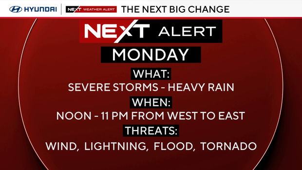
Severe storms Monday in Philadelphia region could affect France-Iraq's World Cup match. Here's the forecast.

A NEXT Weather Alert is in effect on Monday in the Philadelphia region for storms and heavy rain in the afternoon and at night.
Several storms will likely turn severe with damaging winds, intense lightning and the threat of isolated tornadoes.
There will also be periods of heavy rain for parts of the area that may cause flash flooding.
All of this will cause longer evening commute times, delays in air travel, delays or postponements of outdoor activities, including Monday night's 2026 Men's World Cup match at the Lincoln Financial Field and the viewing party at Lemon Hill. Power outages are also possible.
By Wednesday, dry, seasonable, and sunny conditions will return.
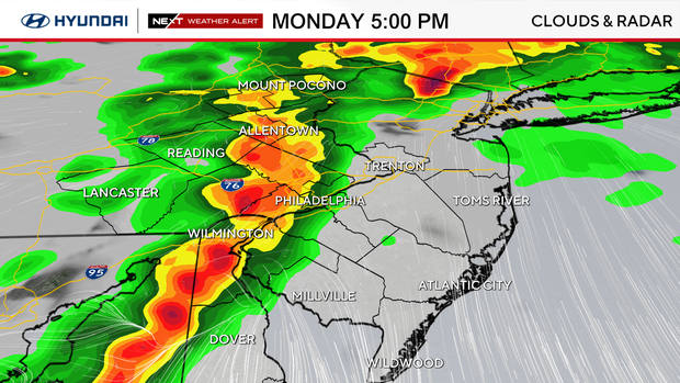
Timing out Monday's severe storms in Philadelphia region
- Noon to 3 p.m.: Lehigh Valley, Berks, Upper Bucks, Upper Montgomery
- 3 p.m. to 7 p.m.: Philly, I-95, Lower Bucks, Lower Montgomery, Chester, Delco, Northern Delaware
- 4 p.m. to 8 p.m.: Inland South Jersey, Jersey Shore, Southern Delaware
Threats of Monday's severe storms
The Philadelphia region is in a level two out of five on the severe storm risk. The Delaware Valley is also in a level two of four for excessive rainfall risk.
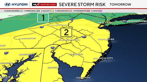
The main threats of the storms will be damaging winds, intense lightning, isolated tornadoes and 1 to 2 inches of heavy rain in some areas, including localized flash flooding.
Here's your 7-day forecast:
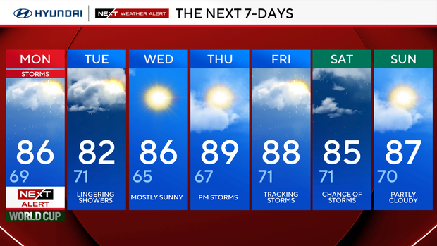
Monday: NEXT Weather Alert for storms. High 86, low 69.
Tuesday: Lingering showers. High 82, low 71.
Wednesday: Mostly sunny. High 86, low 65.
Thursday: P.m. storms. 89, low 67.
Friday: Tracking storms. High 88, low 71.
Saturday: Chance of storms. High 85, low 71.
Sunday: Partly cloudy. High 87, low 70.