Super Bowl weekend brings record highs before cold front hits North Texas

It's finally Friday, and the weather looks dismal across North Texas with cloud cover and patchy fog.
Moisture is riding up and over the cooler air in place this morning, allowing for the stratus deck and fog across the region. The same front that has been meandering back and forth these past few days has stalled over southeast North Texas.
Southeast of the front, temperatures are in the mid to upper 60s, while northwest of the front, temperatures are in the 40s and 50s.
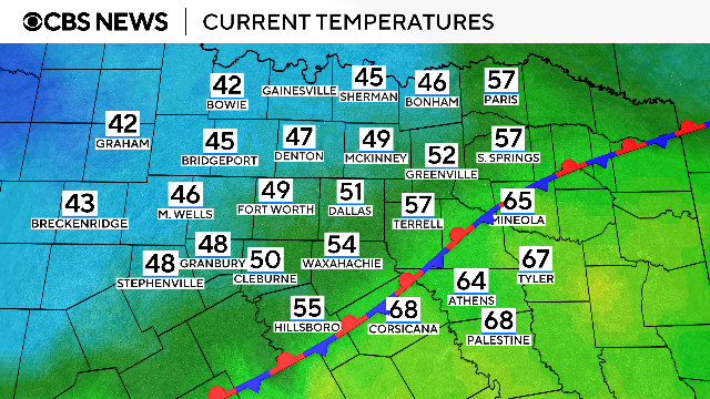
The front slowly lifts north through the day, giving way to a mix of sun and clouds with warming temperatures.
By mid-afternoon, temperatures will be in the upper-60s to low-70s close to the Metroplex, while Red River counties will still be in the upper-50s.
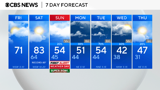
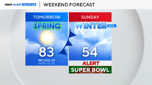
A cooler Super Bowl Sunday in North Texas
The front continues to lift north overnight, pushing temperatures into the upper 60s to start the day Saturday before a strong cold front moves through in the late afternoon. This front brings the colder air mass that will last into next week.
However, temperatures should be close to record high temperatures next Saturday before the frontal passage.
Super Bowl Sunday morning will be much cooler, with temperatures in the 40s to even some upper-30s. Super Bowl Sunday looks to be cool, with temperatures struggling to warm to the mid-50s under partly sunny to mostly cloudy skies.
That's why the First Alert Weather Team issued a First Alert Weather Day, as Sunday temperatures will be nearly 30 degrees colder than Saturday.
Next week's upper-level pattern has a series of short waves moving over North Texas, increasing rain chances Monday through Wednesday and keeping a lot of cloud cover in place. With these factors in place and the cooler air, there will be some relief from the cool temps and rain.
After a warm start to February, North Texas will see temperatures closer to average and even below average next week — so grab the umbrellas and winter coats.