Strong storms possible as cooler pattern continues across North Texas

The high at DFW reached 96 degrees Friday — not exactly a "cool" day, but it did break a three-day streak of triple-digit temperatures.
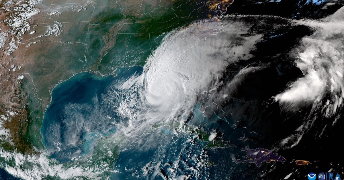
A weak front has pushed into North Texas and stalled, helping to trigger afternoon storms that continued to build into the evening. These storms are expected to taper off late tonight.
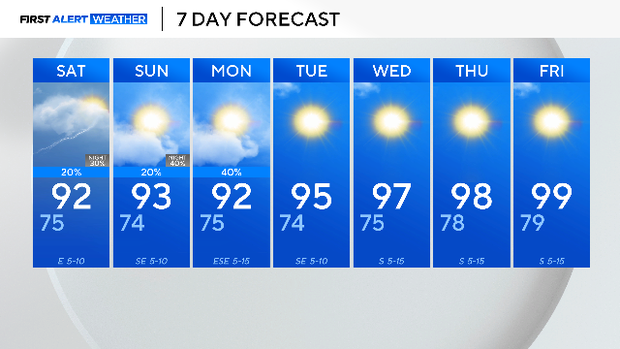
Both Saturday and Sunday are forecast to bring slightly cooler temperatures — a relatively mild start to what is typically the hottest month of the year.
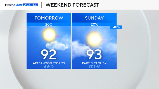
A few pop-up storms could develop Saturday across southern parts of North Texas, but most of the region is expected to stay dry during the day.
Overnight, a complex of storms is forecast to move in from the north, bringing another round of strong storms. While severe weather is not expected, heavy rain, gusty winds, and frequent lightning could pose hazards for anyone outdoors.
Another wave of storms is expected to arrive late Sunday night and linger into Monday morning.
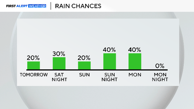
Dry conditions are expected to return by Monday afternoon as sunshine breaks through.
For the rest of the week, typical August weather will settle in across North Texas — hot and dry. High temperatures are forecast to climb back near 100 degrees by the end of the week.