Scattered rain, storms continue overnight in Dallas-Fort Worth

Due to the storm threat, CBS News Texas meteorologists issued a First Alert Weather Day. With more rain and severe weather likely on Friday, CBS News Texas meteorologists could issue another First Alert Weather Day.
It was another active day across North Texas as two convective complexes merged over the area.
Most areas just saw heavy rain, but a few strong thunderstorms also produced small hail.
The storms are coming to an end and skies will continue to dry out from west to east.
An isolated strong to severe storm is possible in Anderson County this evening.
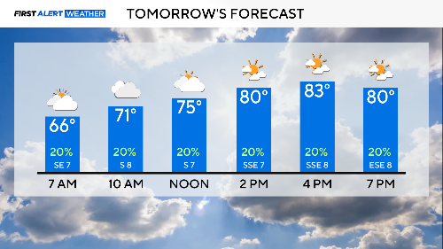
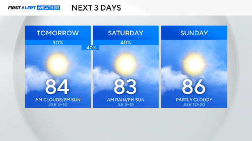
The recent heavy rain may lead to fog Friday morning, especially east of I-35. Scattered storms are possible overnight into Friday morning, mainly to our northwest.
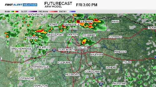
Overall, Friday morning looks quieter than Thursday, which could lead to scattered afternoon storms.
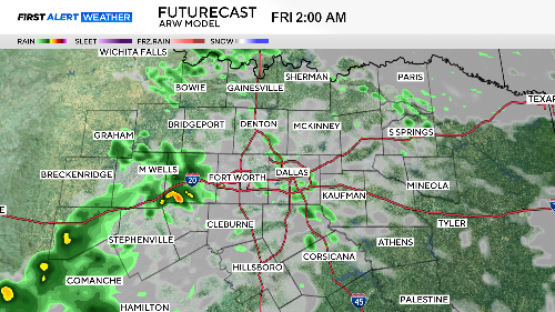
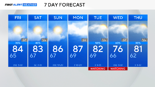
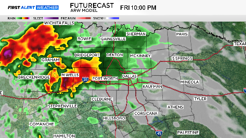
We will be watching for another complex to develop late Friday night into Saturday morning in our northwest areas and along the Red River.
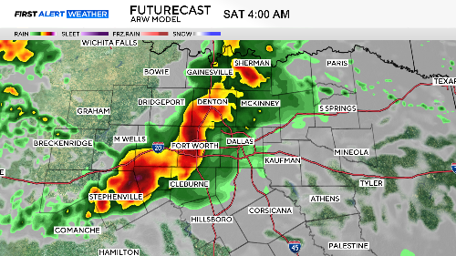
Storms will come to an end Saturday afternoon as temperatures climb into the 80s.
Sunday and Monday will be our dry days before we once again shift into an active pattern with more rounds of storms.
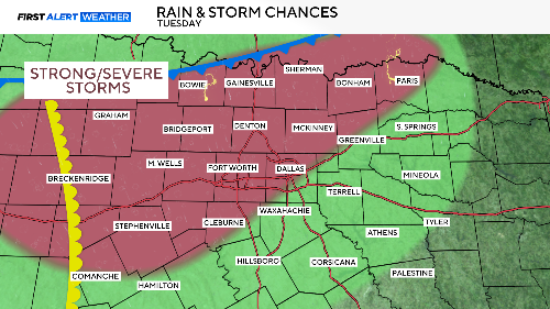
We are alerting you to the potential for severe storms on Tuesday and Wednesday next week.
It is too early to determine threats and the timing of storms, but the ingredients are coming together for more severe weather.
Temperatures remain consistent through next week, with mornings in the mid-upper 60s and afternoons in the mid-80s.