Severe weather risk returns to North Texas after a brief break

NORTH TEXAS —For the first time this year, DFW has hit the 90s for three days in a row. It's yet another hot May in progress.
Two years ago, it was the fourth hottest May in our 125-year history. Last year, in 2023, it was the 18th hottest May.
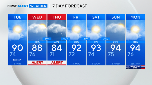
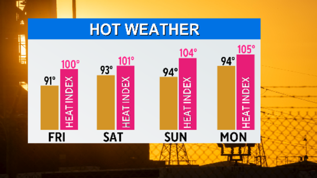
A hot May is about to get hotter, including Memorial Day weekend. Teamed with high humidity, we expect feel-like temperatures over 100 degrees.
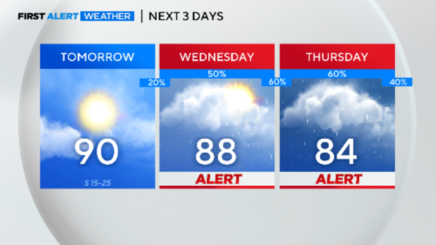
Weather Alerts are in effect for Wednesday and Thursday.
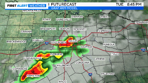
We'll be watching the dry line at the end of the day for storm development. These storms will make a run for the North Texas area if they form.
Keep an eye on the west if you have outdoor activities Tuesday in the early evening.
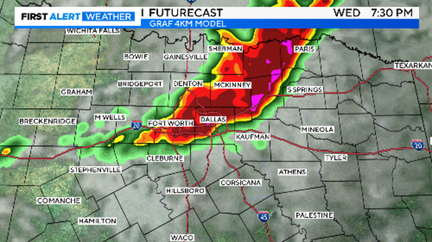
The higher risk of severe weather arrives on Wednesday as a cold front moves in. Strong to severe storms are possible by afternoon. Large hail and damaging winds are the main threats. A flash flood threat is also possible.
This is graduation week for many area high schools. Not only is there a severe weather threat on Wednesday afternoon and evening, but there is another threat on Thursday.
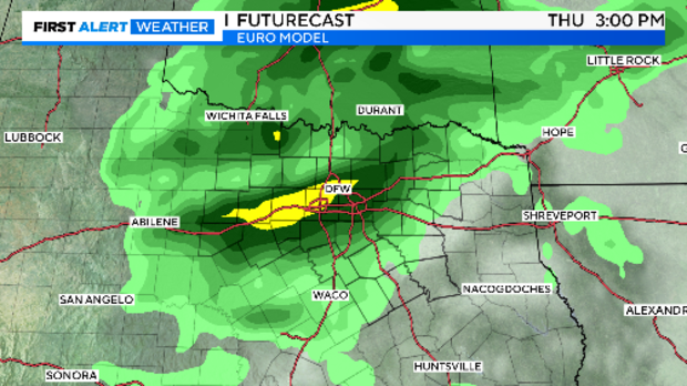
The First Alert Weather team will continue to bring you updates on the risk and timing of these storms. Please stay tuned.
The 7-day forecast takes us across the Memorial Day weekend. We are putting a small chance for afternoon storms across all three days. The heat and humidity will be the main concerns with some many outdoor events planned over the long weekend.