Severe storms threaten North Texas this weekend. Here's the latest outlook

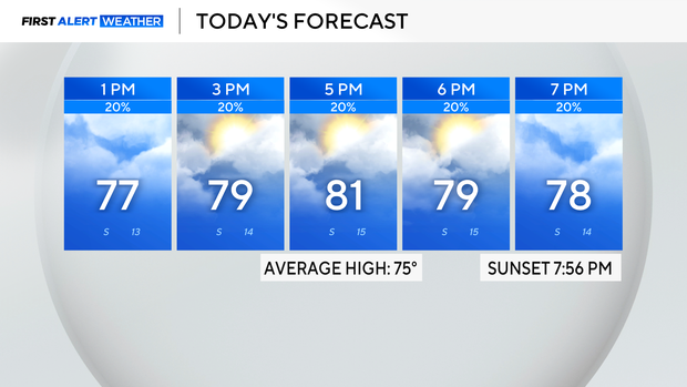
It will be a warm and muggy Saturday. Cloud cover is forecasted to stick around all day, and temperatures are likely to top out in the low 80s this afternoon with a slight breeze from the south.
Sprinkles will be possible throughout the day with a chance of an isolated storm in the afternoon. Cities far to the west have a chance of an isolated severe storm, but most of the activity is anticipated to stay below the severe threshold.
Overnight, a complex of storms will pop up and move from the west to the east. Though the threat of severe weather is low associated with this system, it will be a good idea to prepare for severe weather and have ways to get alerts.
Sunday is a First Alert Weather Day due to the threat of severe storms. If there is clearing and sunshine behind the morning complex, then more activity will flare up and may even be strong in the afternoon.
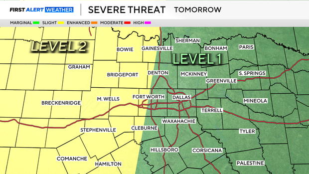
Moving into this upcoming week, the active weather pattern continues. Severe potential will be possible every day through midweek. Now is the time to prepare by bringing anything that could be tossed around and having a severe weather plan in place. Stay tuned for updates!