Severe weather threats loom for North Texas with storms expected overnight and Friday morning


North Texas had a soggy morning on Thursday, with showers moving through and strong to severe storms hitting the west side of the region, leaving a cool and cloudy afternoon and evening.
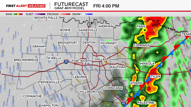
Storms look to roll back in overnight and into Friday morning for North Texas. We'll be looking at scattered showers and thunderstorm activity on-and-off throughout the day.
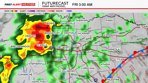
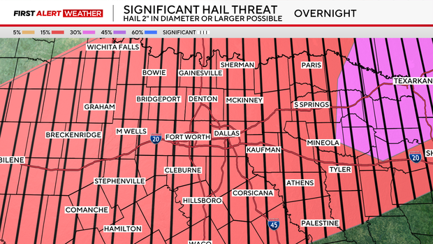
Our severe threats in the morning look to primarily be large hail and damaging wind gusts.
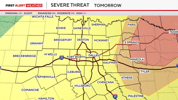
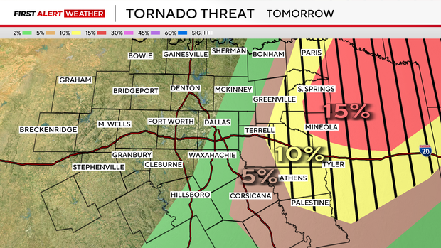
By Friday afternoon, our tornado threat increases, mainly for our eastern and northeastern North Texas counties.
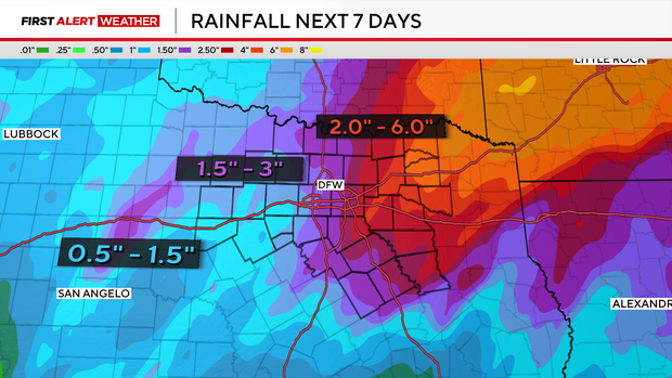
A flood warning is in effect for Rockwall and Hunt counties through 7 a.m. Saturday.
Make sure you have ways to receive emergency alerts and stay weather aware the next couple of days.
Another round of widespread heavy rain, and a few strong to severe storms looks to roll in overnight and into Saturday.
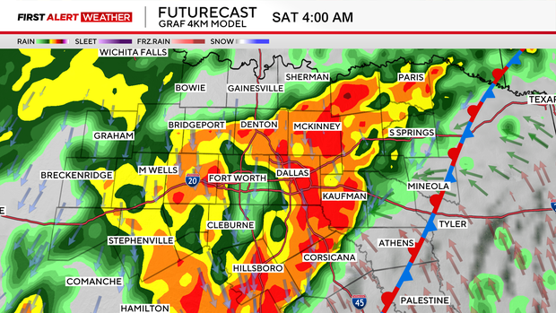
Hail and damaging winds will once again be the primary threats for Saturday. We'll also be looking at a flood threat, especially for our northeastern areas, where hefty rain totals are expected.
Eventually, shower activity starts to clear up through the back half of Saturday, then we'll be drier into the end of the weekend, just much cooler.
A reinforcing shot of cold air sends temps into the upper 50s for highs on Sunday.
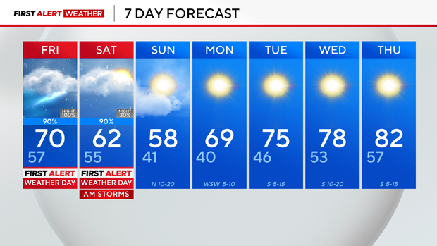
Next week, high temperatures will return to near 80° and there will be plenty of sunshine in the forecast.