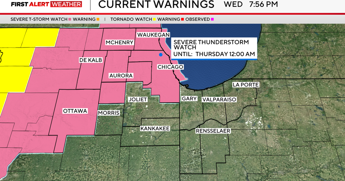
Pleasant, breezy Wednesday across North Texas before severe weather chances return


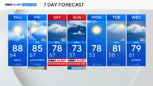
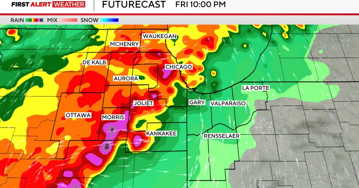
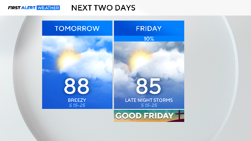
On Thursday and Good Friday, there is not much weather to worry about. It'll certainly be warmer than it should be this time of year, in the mid-to-upper 80s both days.
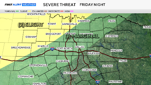
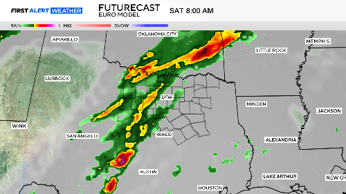
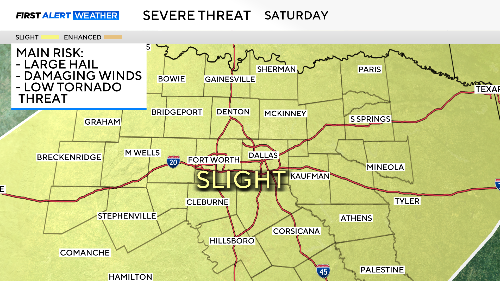
Storms could show up in the later part of the day in our northwest counties. These would go into the evening. Damaging winds and large hail are the main threats. There is a low tornado risk.
Our primary concerns are focused on this weekend. First Alert Weather Days are ahead.
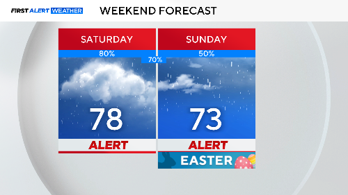
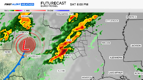
We could see our first round of severe weather in the early morning hours to daybreak on Saturday. Then another round in the late day/evening.
A cold front will deliver the biggest rain of the event starting early Sunday morning. The severe threat will be much lower, but the risk of flash flooding will be high.

The First Alert Weather Team will continue to bring you updates as we get closer to this busy Easter weekend. It appears at this time that the highest severe weather threat will be Saturday.
We are expecting yet another round of strong storms by the middle of next week, the start of some unsettled weather that might go all the way into the next weekend.