North Texans to experience weather whiplash as cool weekend turns into spring-like week
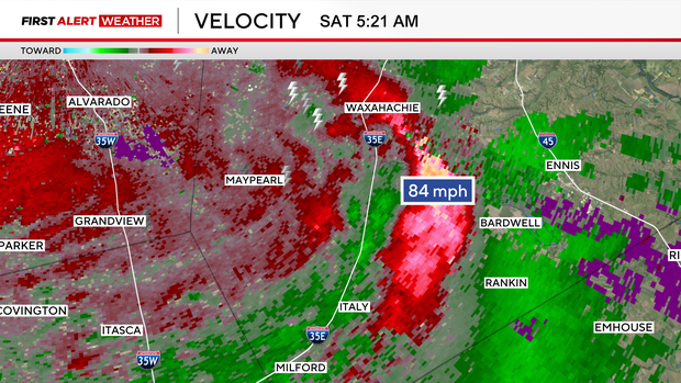
Saturday morning storms created havoc across North Texas, which, unfortunately, turned deadly. Estimated straight-line winds of 80 to 90 mph moved through Ellis County, resulting in an abundance of damage. The velocity product from the radar imagery at 5:20 am on Saturday highlights the bowing echo, which signifies the intense gusts pushing across the region at that particular time.
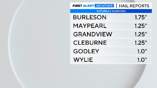
In addition to the winds, hail was also large and damaging. The largest hailstone was reported in Burleson, measuring 1.75 inches, which is the size of a golf ball.
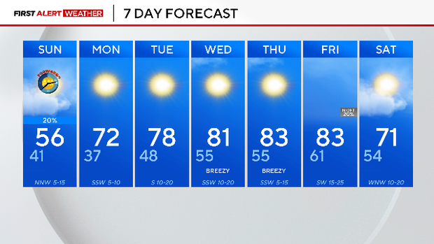
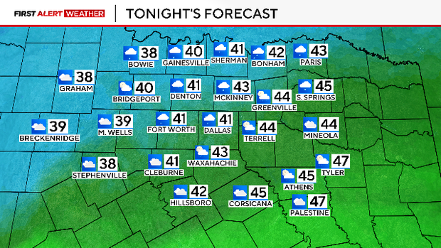
A few showers and mist will persist through the evening into early Sunday morning. Temperatures will be chilly early Sunday, but by afternoon, skies will clear and temperatures will climb back into the mid-50s.
Speaking of Sunday, don't forget to spring the clocks forward an hour!

After Daylight Saving Time, temperatures will rise throughout the workweek. The combination of dry weather and southwest winds will create a high fire danger threat. Please avoid any activities that may cause a spark or flame next week. Stay tuned for the latest updates!