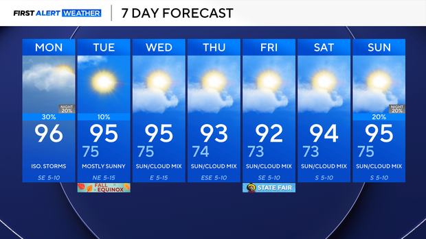
North Texas to see isolated afternoon storm chances Monday


North Texas starts the workweek off hot and muggy, with high temperatures in the middle 90s and feels-like temperatures around 100 °.
A strong thunderstorm will impact northwestern Cooke counties through 5:30 p.m. Winds over 40 mph and half-dollar-size hail are possible.
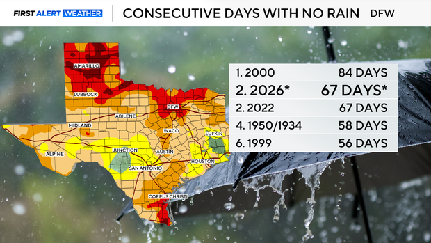
We did not receive any measurable rainfall at DFW Airport on Sunday, so our dry streak is now tied for the second longest on record at 67 days. Grayson County, however, saw over 5 inches of rain on Sunday.
Only a few lucky folks will get a shower or storm on Monday. Tuesday, there is a very small chance for rain in the afternoon, but the next bigger opportunity isn't until the end of the weekend.
Monday is the last day of the astronomical summer, and it has been dry and hot, just to say the least. The Fall Equinox starts at 7:05 p.m. Tuesday, and unfortunately, temperatures are likely to stay above average.
Expect temperatures to be in the mid-70s when waking up on Tuesday, with highs in the mid-90s.
Above-average temperatures with lows in the mid-70s and highs in the 90s will be expected through the rest of the week.