Record high temperatures kick off work week in North Texas, rain on the way will bring a cooldown
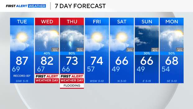
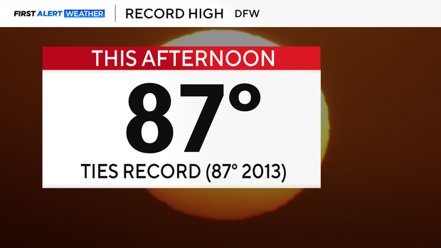
We had yet another record high on Monday and expect yet another on Tuesday.
This means DFW has set record highs three of four days. From mid-November through mid-February, a day at or above 85 degrees is extremely rare. There have only been 50 of them in our 126-year weather history. We'll end up logging three since Saturday.
This historically warm air can hold unprecedented amounts of moisture: the warmer the air, the more water vapor it can hold. For all practical purposes, we have a tropical air mass over us here in mid-November. It has about 300% of normal water content, in fact.
A Pacific front is coming toward us on Thursday to run into his warm, moist air. The results will produce a significant flooding threat.
First Alert Weather Days are issued for Wednesday and Thursday. Our biggest concern is flooding on Thursday night.
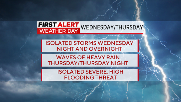
Please try to avoid driving around Thursday night and early Friday morning. The heaviest rain looks to arrive in that window.
We have more rain in the forecast for Sunday and next Monday as the cooler air settles in. This time, the cooler air of fall looks to stick around.