Muggy, Cloudy, Windy Today - Big Storms Tomorrow
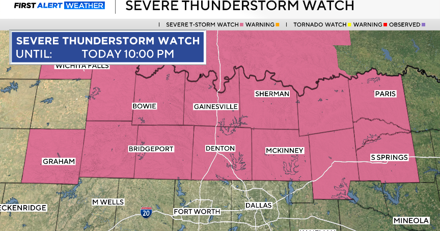
We'll again have scattered showers around this afternoon and evening. Severe weather is expected to develop out in West Texas on the other side of Wichita Falls.
Temperatures will top out in the upper 70's as wind gusts approach 35mph. This is the same forecast as the last five days by the way but big changes are on the way.
I expect we'll awake Monday morning with storms and heavy rain going on northwest and west of the metro area. As the morning goes forward these storms will move east into the metro.
By afternoon the threat of severe weather increases. It'll be windy, humid with temperatures back into the upper 70's. Severe weather in the form of damaging winds and large hail is possible; we could get large cells train over the same areas and produce a flood threat.
We'll be watching for supercells to develop outside of the lines of storms we expect. Conditions are in place for these supercells to form tornadoes.
I suspect this activity will continue at least into the early evening. As an upper level low and surface cold front approach from the west the actiivity will start to pick up again late evening and overnight. There will again a threat of hail and damaging winds.
Very ,very heavy rain (3"-5") is possible along the 35E corridor and east. This includes Dallas county. If this pans out the threat to the Tuesday morning commute is high; the number one cause of weather-related fatality (outside of heat) is flooding.
Half of flooding deaths occur in cars and in most of those cases when it is dark. And of course heavy rain reduces stopping distance and visibility while also making for street flooding.
All this should leave the metro area by late Tuesday morning. Then finally we have some cooler weather. Highs in the afternoon will probably stay in the upper 60's.
We'll have some clouds and maybe some light rain around on Wednesday; if the clouds stick around most of the day highs again will only reach into the upper 60's.
Lows will dip all the way down to the low 40's for Wednesday and Thursday mornings.
Below is the HPC forecast for 5" of rain in north Texas, 3"-4" of total rain is represented by the areas in red and orange:
