Storm Blog: Monday, March 19
1130pm - Tough to see, but this is a map of rain gauges around city of Dallas. For the day some spots just east of downtown have seen over 5" of rain. Here's link to website.
11:27pm - Here is an outline of the counties still under a TORNADO WATCH Until 2am. The severe threat is pretty low even in the watch area. But a few severe thunderstorm warnings could still be possible.
11:20pm - This is a radar estimate of how much rain has fallen across Dallas County. Radar showing a large swath of 3" to 4". This is why we still have Flash Flood Warning in effect until 1am.
11:15pm - Heaviest of the rain finally shifting away from Dallas. Here's radar snapshot.
10:05 - Southwest Airlines reporting a 2-4 hour delay at Love Field due to the heavy rains. American Airlines and their regional carrier American Eagle reports they were forced to cancel 87 flights at DFW. Currently, Oncor is reporting over 21,000 customers without power regionally. In the metro area, 11,000 customers are without power in the Fort Worth area, 8,900 in the Dallas area.
9:56 - TORNADO WATCH now all east and southeast of Metroplex. Heavy rain still over Dallas and Ellis counties. Rain will slowly push east overnight. But FLASH FLOOD WARNING in effect for Dallas and Collin counties until 1am. 8 roads closed due to flooding in Dallas.
8:02 - Current TORNADO WATCH situation
7:31 - New TORNADO WATCH issued for our eastern counties now until 2am.
7:00 - Roughly 9,700 customers without power in dallas 1,000 just east of downtown near the Deep Ellum area -https://maps.oncor.com/images/outages_map_metro.jpg
6:35 - Still no warnings, just heavy rain in Denton, Tarrant and Johnson counties...and temps quickly cool into the 50s. Should be arriving to Collin/Dallas/Ellis counties by 7pm. Tornado threat is limited by a little cap that established itself over North Texas. Our severe weather threat will primarily come from flash flooding potential. FLASH FLOOD WATCH until tomorrow evening for the eastern 2/3 of North Texas
4:56 - No warnings at this time, but TORNADO WATCH until 10pm. Main threat will quickly change to flash flooding over the next few hours into the overnight hours. Could see 2-5" of rainfall...w/ heavy rain even for tomorrow morning's commute.
3:53 - Update from Oncor - nearly 30,000 w/o power in DFW Area.
3:40 - Active Severe T'storm Warning for Wise County with quarter to golf ball hail near Decatur.
3:14 - Update from @oncor: Nearly 15,000 without power in DFW. 8,336 in Dallas; 6,480 in Fort Worth.
3:10 - East Dallas wind damge
3:00 -
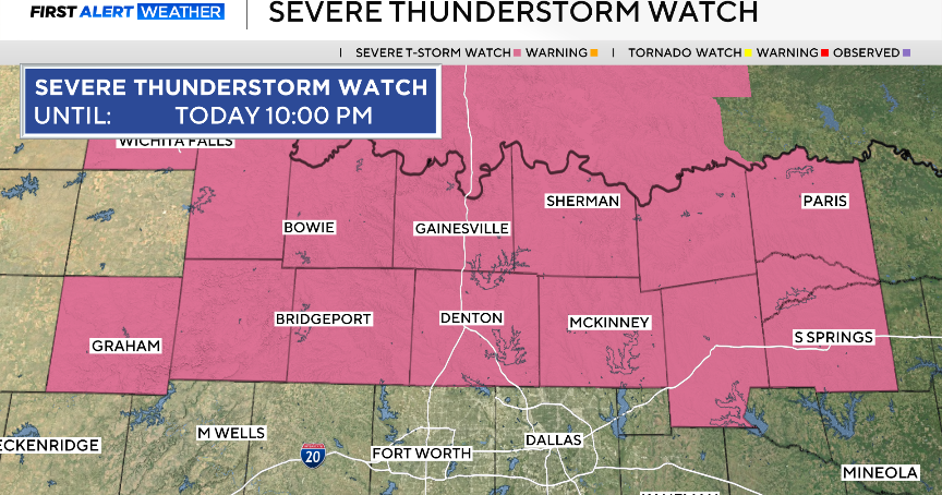
3:oo - TORNADO WATCH issued for most of North Texas, including Metroplex until 10pm.
215pm - First Severe T'storm Warning for parts of Eastland, Erath and Palo Pinto County until 315pm. Large hail and damaging winds possible.
1:56 p.m. – On its website, energy provider Oncor reports 7,781 customers in the Dallas metro area without power and 7,113 in Fort Worth. Since 1:30 p.m., customers in Fort Worth without power has more than doubled –– half an hour ago, Oncor reported just 3,326 in Fort Worth without power. A spokesman said these are mostly wind-related.
133pm - Gary Sutton sent this picture in of an awning that was damaged by the high winds this afternoon. This is in Hurst along HWY 26.
130pm - Winds have been gusting to 50 mph in some locations. Storms still west of DFW. Latest snapshot shows storms moving into NW Wise county to be the strongest. Not severe, but some small hail and gusty winds possible.
1pm - WIND ADVISORY until 7pm. It is windy! Gusts have been above 40 mph out of the south this afternoon. It will stay windy thru the early evening. Line of storms out west is moving toward DFW. So far no severe weather as storms have been mainly behind the the outflow boundary (this is the cooler air that is rushing ahead of the storms). Storms in the cooler air are less likely to be severe. Still can get hail and strong winds in the cooler air, but not as likely as when storms form in warm, moist air. What we will be watching is for storms to form ahead of the line. If that happens, these could pose a large severe risk. Tornado threat is still with us today, but it remains relatively low. Flooding threat tonight will be greatest threat.
