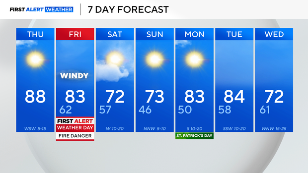
Warm end to the work week in North Texas ahead of extreme fire weather threat

Thursday started out with plenty of sunshine, but clouds will increase as the day continues.
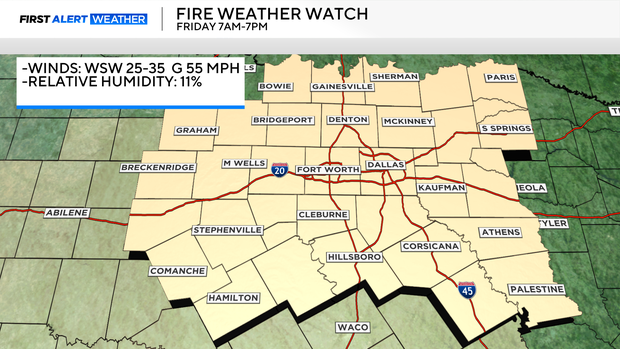
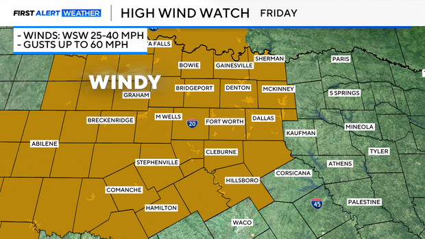
Friday is a First Alert Weather Day because of the extreme fire weather threat and red flag warning. Winds will increase through the morning hours and be sustained near 25-40 mph with gusts up to 60 mph.
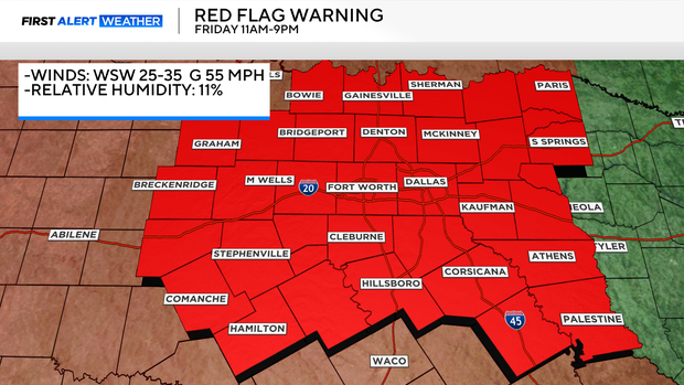
A fire weather watch is in effect Friday from 7 a.m. to 7 p.m. It includes all of North Texas.
A high wind watch is also in effect on Friday.
On top of the warm and windy conditions, the humidity levels will drop to around 10%-11%, leading to increasingly dry conditions.
A powerful low-pressure system is moving into the West Coast Thursday morning, and as it moves closer to the Southern Plains, North Texas' pressure gradient gets tighter and winds increase.
There is a small cooldown into the weekend with partly cloudy skies to start out, but as the low pressure continues shifting northeast, clouds clear and it's back to full sunshine Sunday into Monday.