From Winter Weather To Spring Storms
FORT WORTH (CBSDFW.COM) - A strong upper level low is spinning off the coast of California. This will open up and quickly move toward the southern Plains Wednesday into Thursday. Open up means that it will no longer be a closed low pressure but more like a disturbance that looks like a wave. This will be the catalyst for storms to develop Thursday.
CLOUDS AND DRIZZLE FOR WEDNESDAY…
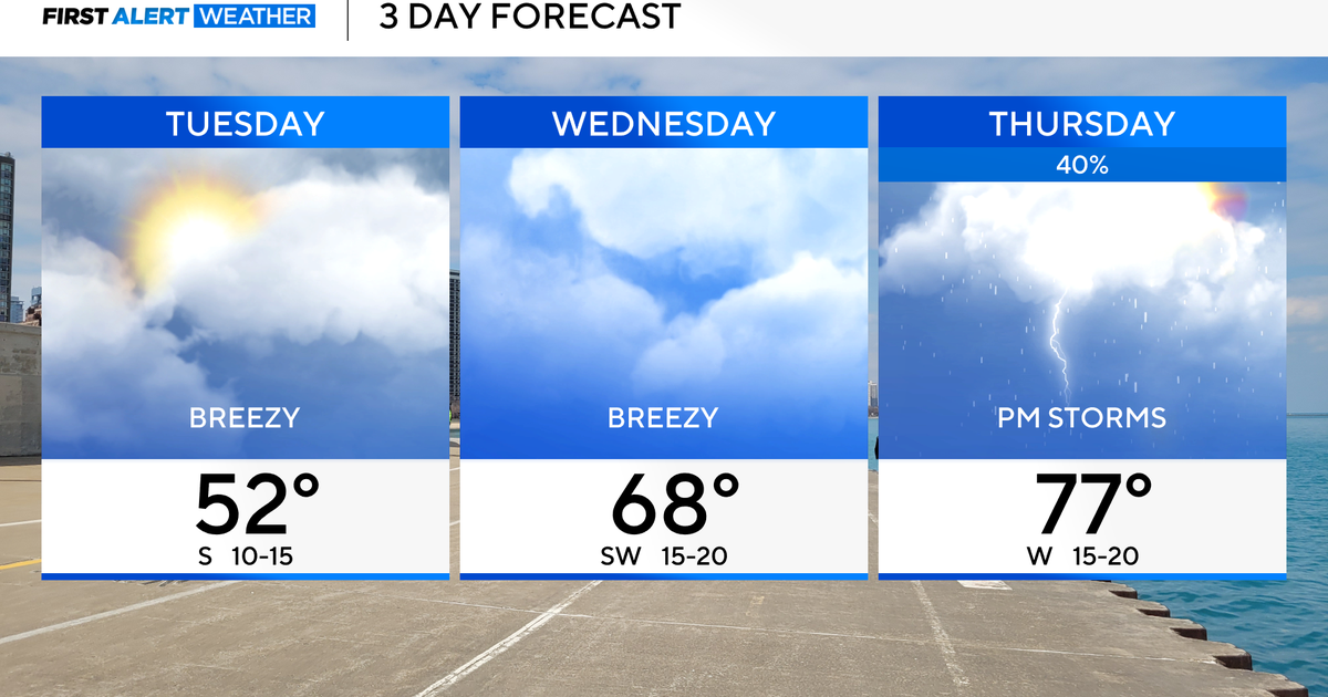
Winds will be turning to the southeast overnight as clouds quickly surge northward into North Texas. Gulf moisture will quickly increase tonight as temperatures will be mild compared to this morning. This morning we dropped into the 30s but tonight and tomorrow morning temperatures will be in the 50s. There will be a little patchy fog and drizzle first thing tomorrow morning. Clouds will hold all day tomorrow with some spotty drizzle and light rain possible. Temperatures will warm into the upper 60s to near 70 Wednesday afternoon.
WEDNESDAY NIGHT INTO THURSDAY MORNING…
Energy from that upper level disturbance will be getting closer. A surface low pressure will be developing in western Oklahoma and tracking east Wednesday night. This low will drag a pseudo dryline/cold front into North Texas Thursday morning. I expect there to be a few scattered showers and maybe an isolated thunderstorm Wednesday night. But the dryline/cold front will be the focus point for storms Thursday morning. It appears this will be moving into the Dallas/Fort Worth area between 9am and 1pm on Thursday. This would be the timeframe for storms here in the metroplex. However, storms will likely be ongoing before 9am for areas west and northwest of Fort Worth Thursday morning. Some of these may be hailers. The dryline/cold front will push east in the afternoon hours on Thursday. It will be in northeastern sections of North Texas that have the best chance of severe weather in the afternoon on Thursday. Hail appears to be the main threat from these storms, but once they get toward the Ark latex a potential for Tornadoes will increase.
Once the dryline/cold front passes Dallas and Fort Worth winds will increase out of the west as dry air is blown in from West Texas. Temperatures will likely warm into the mid 70s Thursday afternoon with some sun. Fire weather concerns will develop for our western counties during the day on Thursday.
A cold front will arrive Thursday evening and temperatures Thursday night will drop into the low 40s by Friday morning. Friday will be cooler with highs in the low 60s.
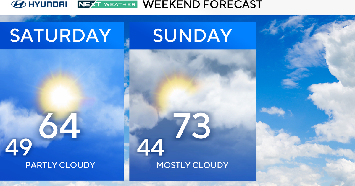
THE WEEKEND…
Saturday will be dry and mild with temps in the 70s. Another chance of strong to severe storms is shaping up for either Sunday or Monday. The timing is still a little uncertain, but we are leaning to more of a Monday timeframe for the chance of more spring like storms.