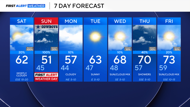
Enjoy Saturday as a soggy Sunday is expected across North Texas

If you have outdoor plans this weekend, you may want to get those done on Saturday as rain moves into North Texas on Sunday.
Saturday will be cooler than average. Cloud cover is forecasted to increase through the day, which will keep afternoon highs in the low 60s. Winds will be from the southeast, gusting up to 25 mph at times.
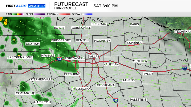
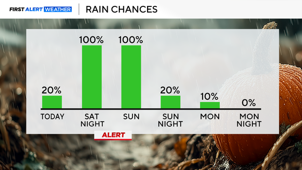
During Saturday, rain chances will increase from west to east as an upper-level low moves over North Texas. Don't cancel outdoor plans yet; the metroplex will likely stay dry most of Saturday.
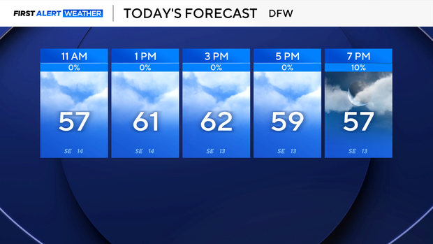
Counties west of the metroplex will see showers and rain in the early afternoon, while the Metroplex will start seeing activity in the late afternoon or early evening. Widespread rain will encompass North Texas overnight.
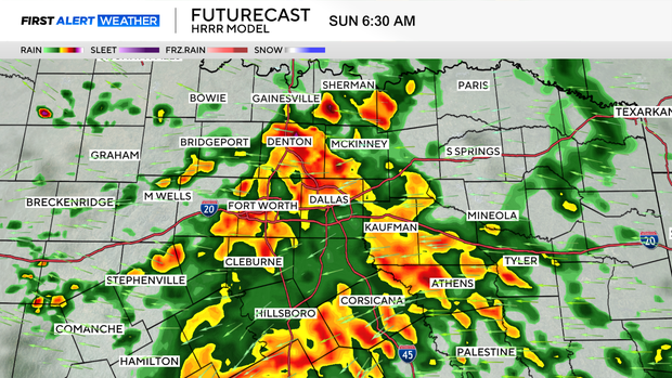
Sunday is a First Alert Weather Day due to disruptive rainfall. No severe weather is expected due to a lack of atmospheric instability. As of now, forecast rainfall totals are between 1/2 and 1½ inches.
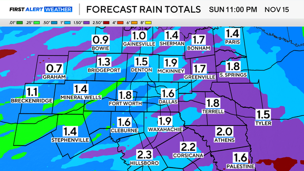
Sunday will not only be soggy but also cool. Temperatures are forecasted to be below average, with lows in the mid-40s and highs in the low 50s. Winds from the east may make it feel even cooler. Rain will wrap up from west to east during the afternoon. However, lingering sprinkles will be likely overnight into early Monday morning.
A ridge of high pressure begins to develop Tuesday, warming temperatures up and allowing for more sunshine to break through the clouds. The next disturbance is expected to pass through North Texas on Thursday, bringing another opportunity for an isolated storm. Stay tuned for the latest forecast updates!