Election Day temperatures to reach 80s before unsettled weather moves into North Texas, prompting severe threat
It was yet another day in the 80s at DFW, the sixth on in a row. That makes an even dozen 80-degree days this year so far, just 62 days into 2026. This ties for the most ever at this point in the new year. In our 127-year climate history, there have only been three years that have seen 200 days at 80° or higher. All of them have occurred since 2022.
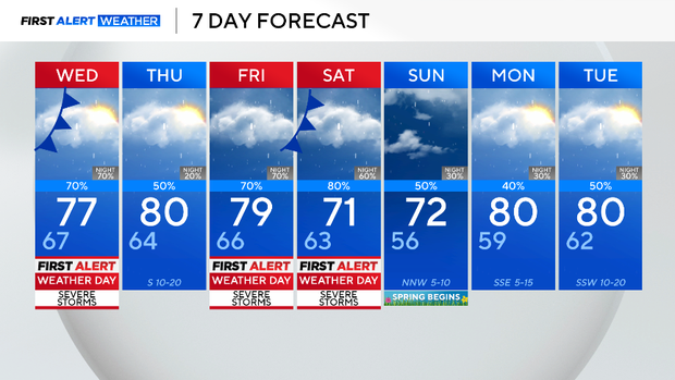
Wednesday, North Texas can expect its first round of severe weather this spring storm season. More threats follow as we finish the week and get into the weekend.
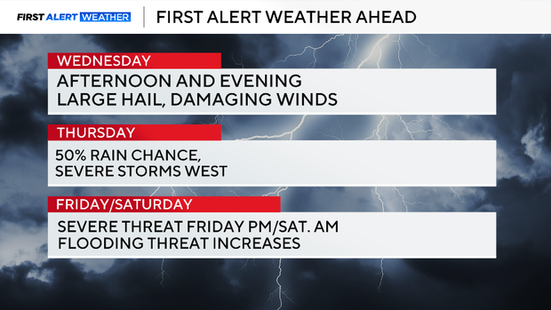
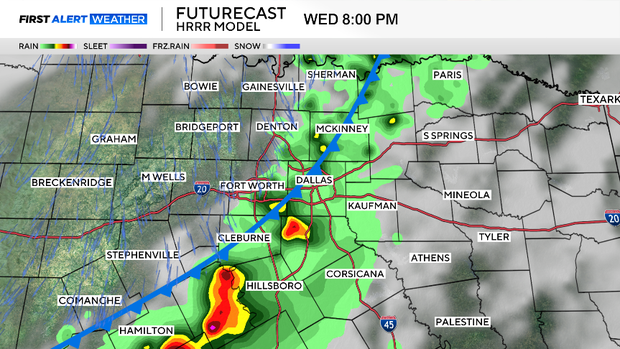
We are expecting a severe weather threat to show up late in the day and go into the evening. Large hail and damaging winds are the primary threats. There is a very low tornado threat with these storms, but not zero.
Storms on Thursday will be non-severe; most of the activity will be to our north. We'll watch dryline storms to our west; they'll likely make a run for us later that night into our northwestern counties.
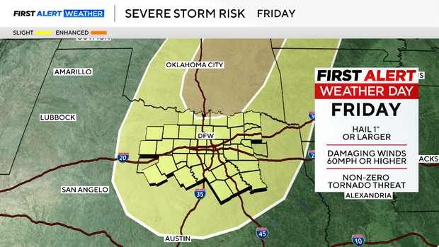
Another front comes in on Friday. We are expecting more coverage in storms and heavy rain with this round. The heavy rain could linger into the first half of the day on Saturday.
We have jumped into a very active weather pattern as we start March. Several rounds of rain/storms are expected next week as well. In all of this will be some impressive rainfall amounts, and the risk of flooding picks up on Friday and Saturday.