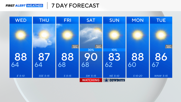
Dry conditions, above average temperatures stick around North Texas through the weekend
It was another above-average day for North Texas; the highs for this time of the year should be around 10 degrees cooler.
Unfortunately, it will not feel like fall for the next several days. Tuesday night, temperatures will cool off once the sun sets. Due to clear skies, the radiation will seep out of the atmosphere, allowing for temperatures to drop overnight.
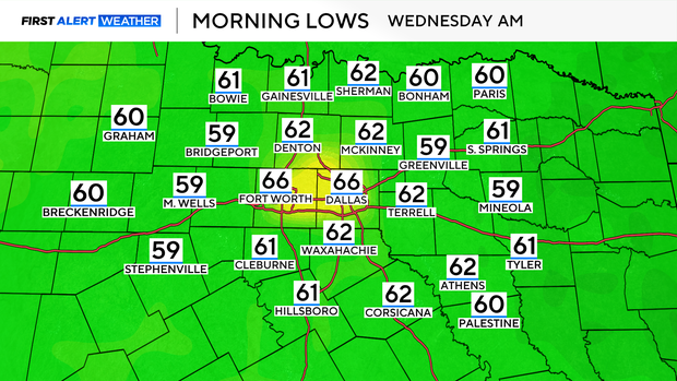
Wednesday morning will be nice and mild in the mid-60s.
A ridge of high pressure in the upper levels of the atmosphere will continue to dominate over the next several days. This will allow for temperatures to reach above average and skies to stay dry. A few clouds are expected to build into the forecast on Thursday, but no rain is expected.
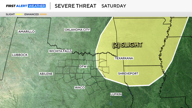
Rain returns to North Texas forecast this weekend
The next rainmaker won't be expected until this weekend.
A cold front will likely move through North Texas in the late afternoon on Saturday, bringing storm chances Saturday evening. In fact, the Storm Prediction Center has high confidence for scattered severe storm development along the front Saturday for counties to the east of the metroplex. Hail, damaging winds, and even an isolated tornado are possible.
Though the front will dip temperatures into the lower 80s on Sunday, it is still above average. There is another front that will move through midweek next week, which will bring more seasonable weather.