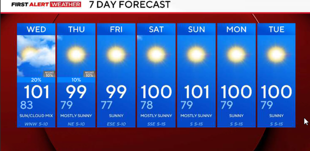
Extreme heat amid wildfire threat in North Texas; temperature to drop a few degrees in upcoming days


The upper-level ridge is finally beginning to retreat west, but not quickly enough to bring much relief Tuesday.
A southwest component to the wind is still producing downslope/compressional warming, helping temperatures soar despite the clouds and spotty showers seen Tuesday morning.
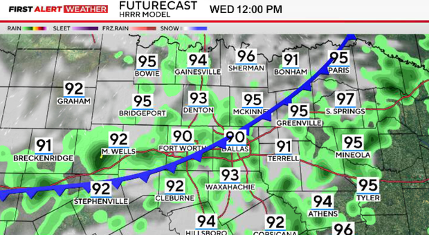
The more noticeable change arrives on Wednesday as a weak front moves south out of Oklahoma. That front will bring a 20–30% chance of showers and thunderstorms and should finally begin to knock temperatures down a few degrees.
The other concern remains wildfire activity. Extremely dry vegetation, temperatures above 100° and afternoon humidity as low as 20–25% will continue to support new fire starts.
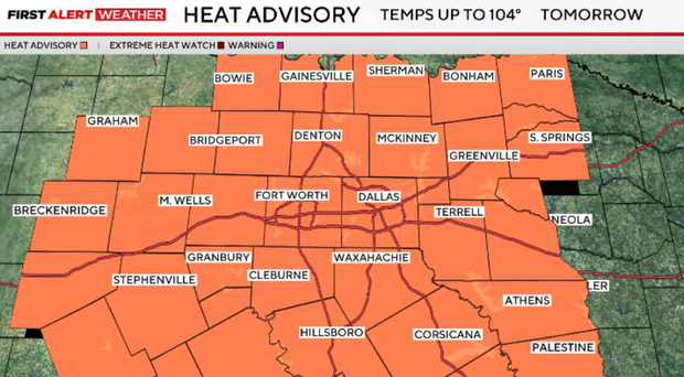
Any lingering showers will quickly fade, and most of North Texas will be dry Tuesday evening. Temperatures will remain dangerously hot through the early evening after highs generally between 102° and 104°, with some western locations potentially hotter.
South winds around 10–15 mph, combined with very dry vegetation and low humidity, will keep the grass fire threat elevated. The scattered rain on Tuesday morning was simply not widespread or heavy enough to provide meaningful relief for the ongoing fires or drought conditions.
Another very warm night is ahead. A weak front currently sitting across Oklahoma will begin moving south toward North Texas overnight. A few showers could approach northern areas toward Wednesday morning, but coverage remains low.
Wednesday brings our next opportunity for some changes.
Heat advisory Wednesday
A heat advisory will be in effect from 9 a.m. to 9 p.m. across North Texas, as dangerous heat continues.
The front will move south through North Texas during the day, with a 20–30% chance for isolated showers and thunderstorms, including opportunities during both the morning and afternoon. Most communities will still stay dry, but any storm that develops could produce lightning and brief strong or gusty winds because of the very hot, deeply mixed atmosphere.
Temperatures will remain very hot on Wednesday, but northern areas may begin seeing highs fall back into the upper 90s, while locations farther south remain in the triple digits.
A little break from the heat end of week
The front and the westward shift of the ridge should finally bring a modest break from the most extreme temperatures.
Highs are expected to settle into the upper 90s to around 100° Thursday and Friday. A few lingering isolated showers or storms may remain possible into Thursday morning, but widespread rain is not expected.
Unfortunately, the modest break does not last. High pressure is forecast to build east again this weekend, causing temperatures to climb while rain chances decrease. The longer-range outlook continues to favor hotter-than-normal temperatures into the first week of September, so while we may temporarily step down from the 105°+ heat, there is still no significant or lasting cooldown showing up.