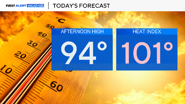
Heat indices to range from 100 to 105 degrees across North Texas as humidity increases

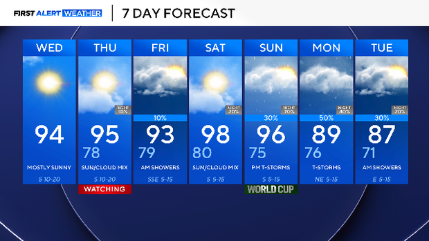
Wednesday will be a hot and humid day once again with highs in the mid-90s. Due to the abundance of moisture in the atmosphere, heat index values will approach 100° to 105° during the afternoon. Expect mostly sunny skies, with southerly winds gusting up to 25 mph at times.
A pop-up shower will be possible in counties east of I-35 and in Central Texas, but most will stay dry.
The First Alert Weather Team is watching for a potential First Alert Weather Day on Thursday due to a possible advisory and temperatures in the mid-90s, with a heat index around 105 degrees.
The upper-level ridge will gradually weaken on Thursday, allowing a cold front to move toward and stall at the Red River in the evening. Rain chances will be highest north of I-20 and along the Oklahoma border late Thursday night through Friday afternoon.
No severe weather is expected at the moment; the biggest risk is lightning and flooding.
Saturday will stay mostly dry and hot. However, the next big weather maker is on Sunday. This will lead to additional storm opportunities through Tuesday.