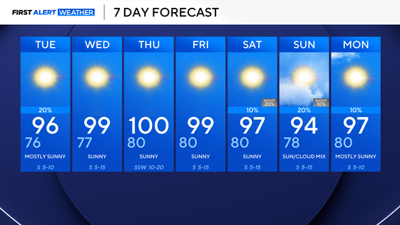
Scattered, isolated storms possible as temperatures peak into upper 90s across North Texas

After Sunday's scattered storms off to the east brought decent rains to some, we have a lingering stalled boundary that will be the focus point for some storms on Monday but should stay well east of the I-35 corridor.
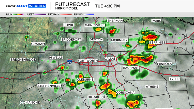
Tuesday, chances for rain will increase slightly across the metroplex as an upper trough lingers in the area, and with hot temperatures and increasing humidity, that will be the best chance of rain until the weekend. It is because of this that portions of North Texas, including the metroplex, are under a level 1 risk for severe weather on Tuesday, with the main risks being strong winds and heavy rainfall. Make sure to take an umbrella tomorrow if you are outdoors.
After this, chances of rain disappear until the weekend, and were back on with the heat and humidity as temperatures remain in the upper 90's, with heat index values between 100 –105°F