Storm chances rise this week, bring possible high winds and hail to North Texas

We're tracking multiple rounds of scattered storms through midweek. While coverage will be spotty, a few storms on Tuesday could become strong to severe west of our area. During the evening hours, some of the storms could move into our northwestern areas, including Montague, Cooke, Wise, Jack, Palo Pinto and Parker counties.
Wednesday will have the highest coverage and potential for severe storms. After that, we will have a brief dry break late week before the next system sweeps a cold front through North Texas on Saturday.
There is also a very low, conditional chance for a storm to develop along the dryline west of the region on Monday afternoon. If one does form and move east, it could briefly become strong during the evening, with hail and gusty winds, but confidence is low on these cells moving in. Any isolated activity dissipates early, leaving us with partly cloudy skies and muggy conditions overnight
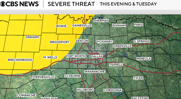
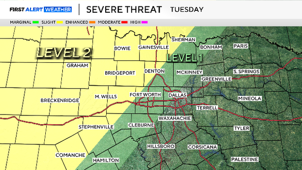
Most of Tuesday will be warm, humid, and breezy, with highs in the low 80s. By the afternoon and evening, storms developing along the dryline to the west will move toward North Texas. Coverage remains scattered (around 30%), but a few storms, especially north of Highway 121 / US-377, could become strong to severe, producing large hail and damaging winds. Storms may linger into the overnight hours before weakening.
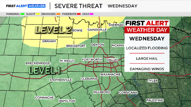
Wednesday looks like our most active day of the week. Another disturbance provides a stronger lift, leading to more widespread scattered storms (around 60%) across North Texas.
However, morning clouds and leftover rain may limit how unstable the atmosphere becomes, which will determine how strong storms can get.
If storms do intensify in the afternoon and evening, a few could be strong to severe, with hail and damaging winds. Storms should begin to exit to the northeast late Wednesday night.
On Thursday and Friday, there will be a brief break in activity.
We return to partly cloudy, warm conditions, with fewer rain chances (20%) as we sit between systems with limited forcing in place. Highs in the mid to upper 80s with clouds and sunshine.
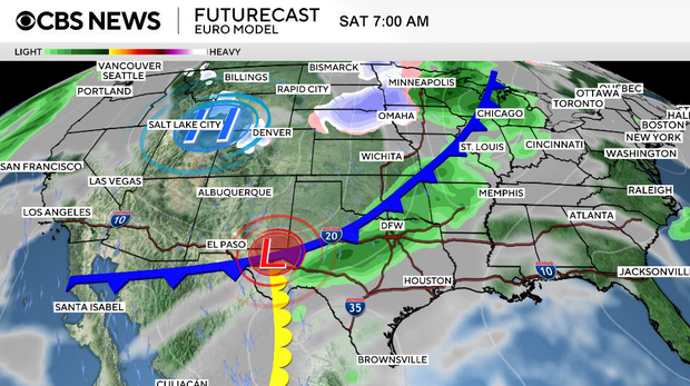
On Saturday, another system moves through and it will finally push a cold front through North Texas, bringing cooler air and another round of showers and thunderstorms.
This activity is expected to develop early Saturday, likely in a more organized line. After the front moves through, we begin to dry out and cool down, leading to improving conditions later in the day. Lows on Saturday night will drop to the 40s.
Sunday will be mostly sunny with highs in the 70s.