Cold front brings gusty winds, elevated fire threat to North Texas
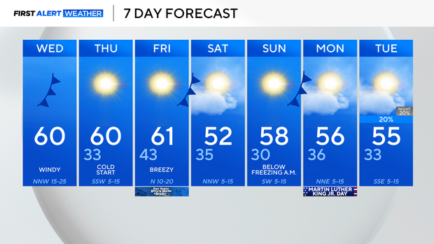
Temperatures across North Texas early Wednesday are in the 40s, so jackets will be needed when heading out the door.
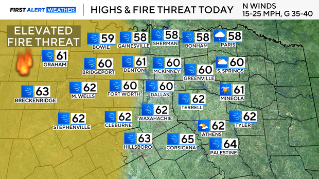
As a cold front moves through, gusty winds are expected in the afternoon up to 40 mph. Expect cooler highs near the 60° mark and an elevated fire threat west of I-35 due to the gusty winds and low humidity.

Behind this front, temperatures drop to near freezing by Thursday morning across the DFW, with other areas likely falling below freezing. Winds shift back to more of a southerly flow, which keeps North Texas above average Thursday afternoon. Low temperatures will dip back into the 40s overnight into Friday.
Another cold front moves through on Friday, which will drop temperatures below average on Saturday, with highs in the 50s.
Most of North Texas likely will wake up to temperatures in the 20s by Sunday morning; however, temperatures will climb back above average by the afternoon. Conditions remain dry into Martin Luther King Jr. Day.