Sunday stays pleasant; severe weather chances return to North Texas midweek

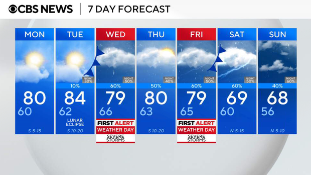
Sunday is the start of meteorological spring, and it will be a warm one with highs in the upper 70s and lower 80s.
DFW will stay dry and breezy with winds between 10-20 mph and gusts up to 25 mph. There is a small chance for a shower or thunderstorm on Sunday night across the Red River counties and possibly slightly further south, as a front tries to push through.
Looking ahead to the upcoming workweek, the weather turns much more active. Chances for rain and thunderstorms begin Wednesday and continue into next weekend. There are two First Alert Weather Days in place for both Wednesday and Friday.
Cloudy skies will continue for the next few days before the rain moves in.
Lows Monday morning will be in the upper-50s to low-60s with cloudy skies around sunrise. Cloudy skies will continue through Monday afternoon, with highs reaching into the upper-70s to low-80s.
Tuesday will be the same, but rain moves in Tuesday evening after sunset. That will kick off a wet and stormy weather pattern.
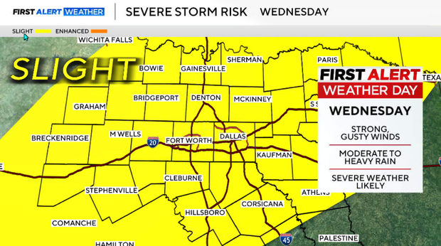
Strong to severe thunderstorms will be possible both Wednesday and Friday, with all forms of severe weather possible. Daily shower and thunderstorm chances continue from midweek onward, with 1-3" of rain possible.