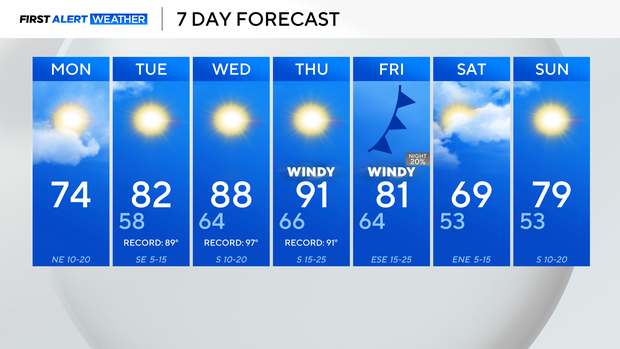
Cooldown will be short-lived for North Texas as temperatures rise into upper 80s, 90s by mid-week
After a steamy weekend in DFW, a cold front is pushing through Monday, dropping temperatures closer to average.
Temperatures on Monday morning are mild in the 50s and 60s.
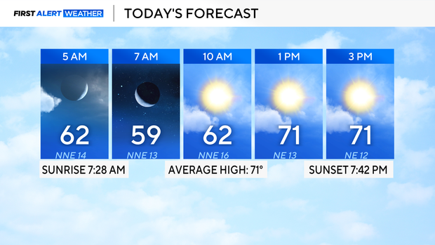
Looking ahead to the afternoon, highs rise into the lower to mid-70s, with an increased fire risk across the western counties.
The cooldown will be short-lived as another bridge of high pressure builds in and raises temperatures back into the 90s by Thursday.
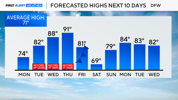
Thursday will be the only day when DFW may tie or potentially break the previous record of 91°. A cold front will approach and move through on Friday, which will increase winds and drop temperatures. There is a slim 20% chance of rain as the front moves through, but most areas should remain dry.
Highs rise into the 80s by early next week.