Near-record high temperatures expected, fire danger increases for North Texas
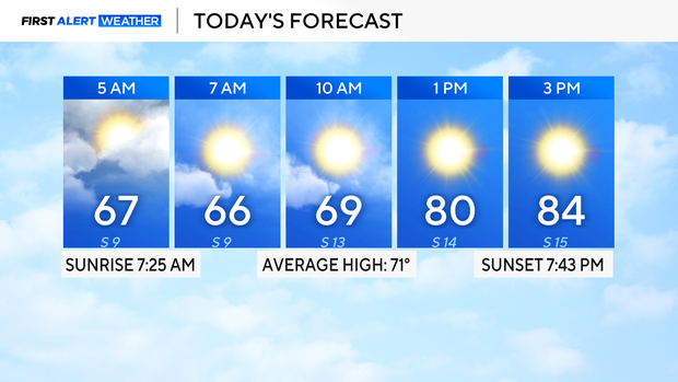
Wednesday morning, temperatures are once again mild in the 60s across North Texas.
Expect plenty of clouds before the afternoon sunshine. It will be breezy at times, with some gusts up to and possibly over 20 mph.
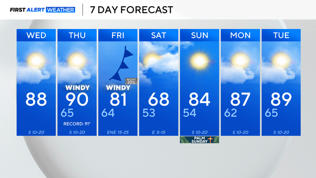
The warming trend continues with highs near 90° by Wednesday afternoon. The forecast is for 90° on Thursday, but with the help of southerly winds, DFW may tie or break the previous record of 91°.
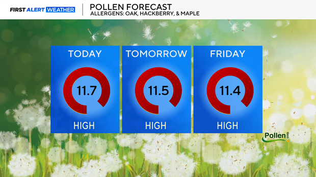
Be sure to keep taking your allergy medicine as the pollen count remains high for the rest of the week. An elevated fire threat will also continue for the western counties.
Looking ahead to Friday, a mainly dry cold front will move through, and winds will sharply increase. Expect wind gusts up to or possibly over 30 mph at times, especially by the evening.
Behind this front, temperatures briefly drop below average for just the fourth
time this month.
By Palm Sunday, it will warm right back in the 80s, and temperatures will continue to stay above average again through the end of March.
There are some signals that rain chances may return by the middle of next week.