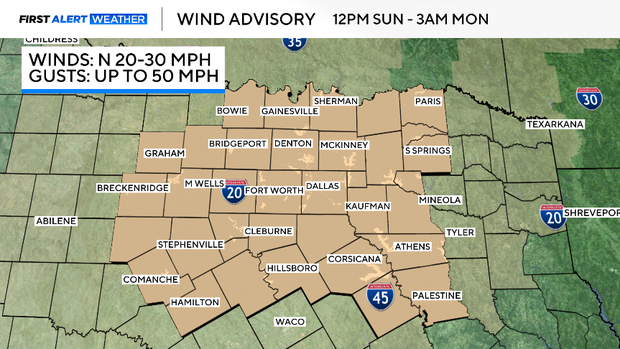
Wind advisory in effect as cold front moves through North Texas, dropping temperatures into 30s
Sunday was another record-breaking day in North Texas, as our high temperature reached 85° at DFW. That breaks the prior record of 83°, which was set back in 2016.
Average highs this point in the year are in the mid-50s, so we are well above normal.
A cold front is on the move through the state, and that will lead to a steep drop in temperatures by Monday. It also brings strong winds along with it, sustained 15-30 mph, with gusts as high as 45-50 mph. A Wind Advisory is in effect through early Monday morning.
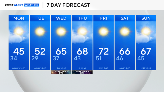
Make sure you bundle up as you head out Monday morning, as our morning lows drop close to freezing, but it will feel about 10° colder thanks to the wind.
By Tuesday, we start a steady warming trend. We'll still be just below average Tuesday afternoon, with highs in the lower 50s.
But by Wednesday, New Year's Eve, we are back into the mid-60s, and continuing to warm, eventually into the lower 70s by the late week.
Expect lots of sunshine and dry time in this extended forecast, with no chances for widespread rain through the end of the 7-day.