Warm stretch continues for North Texas, with elevated fire threat on Tuesday
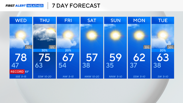
It has been a rather warm start to January; in fact, temperatures over the past five days have been well above average from anywhere from 10 to 20 degrees. The warmth is forecasted to continue through the rest of this work week.
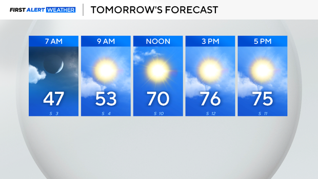
Wednesday, expect temperatures in the morning to be in the upper 40s and increase into the upper 70s by the afternoon. Winds will be from the southeast, 5 to 10 mph. The winds will help fuel the atmosphere with moisture; therefore, cloud cover will increase throughout the day.
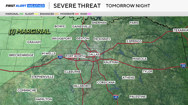
Late Wednesday night, a cold front will slowly glide across the northwestern corner of North Texas. This front may initiate some showers and a few isolated strong storms.
As of now, model timing and consensus are inconsistent, but the Storm Prediction Center has highlighted a level 1 out of 5 threat for severe weather late Wednesday night for counties to the northwest of the metroplex. Now is the time to prepare for the potential of damaging winds and hail.
Thursday, the threat for severe weather shifts eastward. Areas along and east of I-35 should prepare for storms and a few isolated severe storms are possible. Not everyone is guaranteed the chance of rain or a strong storm, but the threat is possible.
Friday, more storm activity will be possible with the front in East Texas. The metroplex should eventually see skies clearing by the evening. The colder airmass finally settles into the forecast this weekend. Skies will be sunny, and temperatures will once again be seasonal in the 50s.