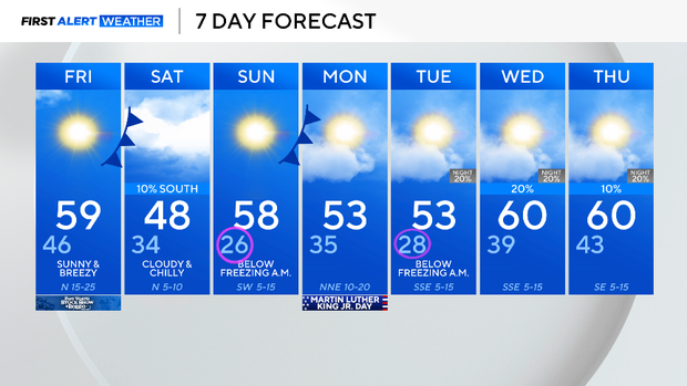
Warm end to the work week in North Texas before temperatures drop behind cold front


DFW Airport got down to freezing Thursday morning for the first time this month. Last year, January delivered 20 freezes. It has been a very mild winter so far.
We are halfway through meteorological winter (Dec. 1 to Feb. 28), and it's the third warmest first half of winter on record (1998-2025).
A cold front sweeps in on Friday morning and brings in some of the coldest air we've had this season. High winds on Friday afternoon mean an elevated fire risk.
Highs on Friday will be in the upper 50s, like Thursday. This cold front delivers clouds on Saturday, with a flurry or two possible.
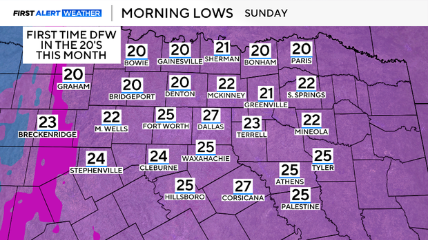
The bigger story is how cold it gets. By Sunday morning, we'll have temperatures in the upper 20s.
This is not only one of the warmest starts to winter, it is also one of the driest. We've only logged 0.09" of rain since the first day of December.
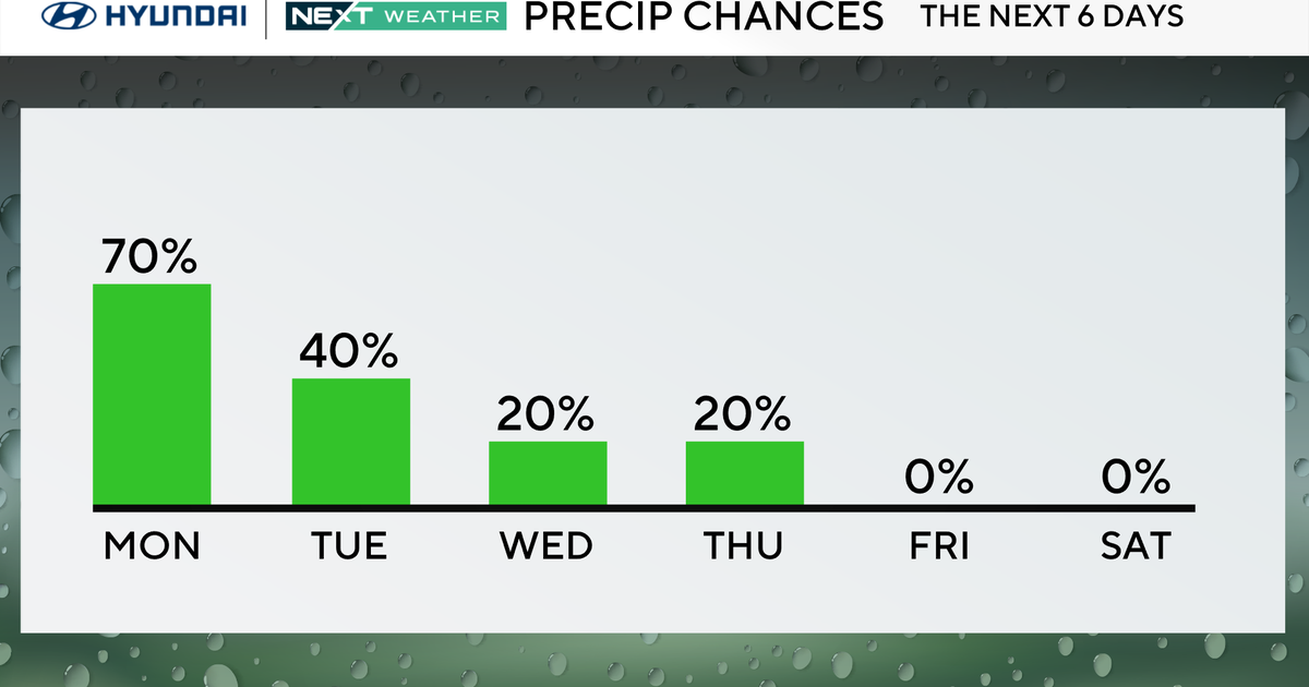
Rain chances show up in the middle of next week and stick around for a few days. We could spend the second half of the month with above-normal rainfall.