Cloudy, breezy Thursday for North Texas as temperatures remain above average
We just had the coolest day of the month so far, a high of 86 degrees — seven degrees above normal. Halfway through October, and this is the fourth warmest October on record, since 1899.
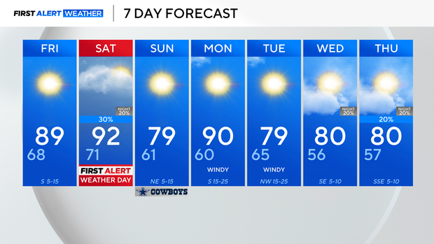
A warmer day can be expected on Friday, and a little breezy, we'll have a high in the upper 80s. A strong cold front sweeps over North Texas on Saturday. On strong southwest winds, we'll likely get into the 90s.
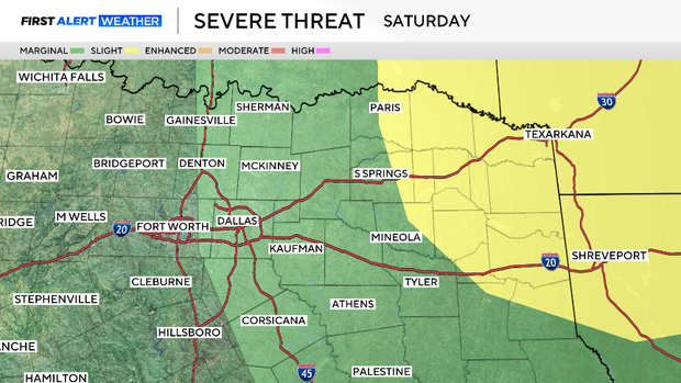
There will be a stout cap (a layer of warm air just off the surface) that will be tough for any storms to punch through. A First Alert Weather Day has been issued for Saturday, with primary timing during the afternoon and evening. Severe weather threat is more likely to our east, but a marginal risk is in place for parts of the metroplex in the afternoon.
We'll enjoy sunny skies, low dewpoints, and breezy conditions on Sunday.
Please be aware of the high grass fire risk given the dry conditions.
Temperatures jump right back into the 90s on Monday before the next front arrives early Tuesday. Rain chances and cooler temperatures look to stick around a little longer next week.