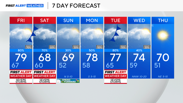
Severe storm risk Friday, flash flood threat Saturday in North Texas
Friday morning looks to start with very spotty, light showers across the region, with little impact on the morning commute.
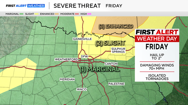
As the day progresses, however, a dryline will approach from the west, helping to initiate scattered thunderstorms by the afternoon, lasting through the evening.
The primary timeframe for thunderstorms and the threat for severe weather looks to be between about noon and 8 p.m.Friday. All threats are on the table: large hail, damaging winds and a tornado threat.
Showers will then take a break for a few hours going into Friday night, but by Saturday morning, a cold front moves into our area, bringing heavy and more widespread rain along with a few thunderstorms.
The primary threat Saturday morning and early afternoon will be for flash flooding. However, we do still have a marginal severe threat for North Texas, which does increase from a 1 to a 2-out-of-5 risk for our southeastern counties.
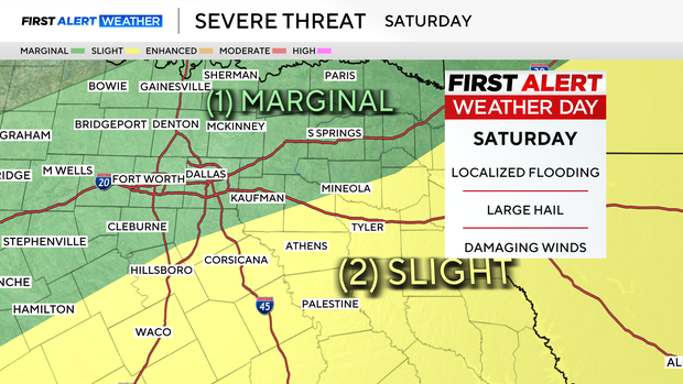
Rain totals are expected in the 1-3" range generally, with isolated pockets of 4+".
Showers look to clear up to the southeast on Saturday afternoon, with only isolated shower chances on Sunday, and scattered showers on Monday.
The threat for severe weather returns Tuesday, as an area of low pressure and a cold front move into the region, prompting another First Alert Weather Day heading into next week.
Stay safe and stay weather aware as we get through the next week or so.