Potential record-breaking heat, gusty winds and high fire danger on deck for North Texas

Buckle up for a bit of a temperature rollercoaster this weekend.
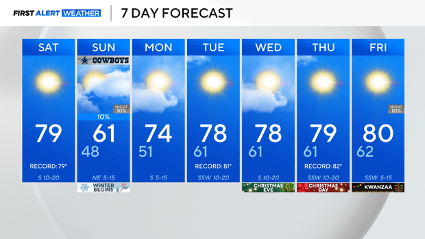
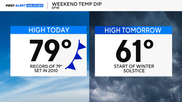
Highs are expected to flirt near 80 degrees across North Texas Saturday, which will potentially break the record for the daily high temperatures on this date, which was set at 79 degrees in 2010.
Temperatures will be above average due to compressional heating ahead of an approaching cold front and from winds from the southwest, ushering in a breezy and dry airmass.
High fire danger is expected Saturday too, due to the winds gusting up to 25 mph, low relative humidity levels and warmer-than-average temperatures. Please avoid any activities that may cause a spark or a flame.
The cold front will approach the Red River Saturday night and sag southward overnight. The front will increase cloud cover and dip temperatures for Sunday. A few light spotty showers will be possible; however, heavy downpours and strong storms are not expected.
A ridge of high pressure returns, causing a temperature increase for the holiday week. This Christmas will be sunny and warm; in fact, it may be one of the top five warmest Christmases in history. Santa will definitely not need his coat!