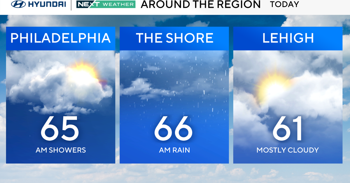
Hot, humid holiday weekend ahead of possible storms on Memorial Day
Happy Saturday, North Texans!
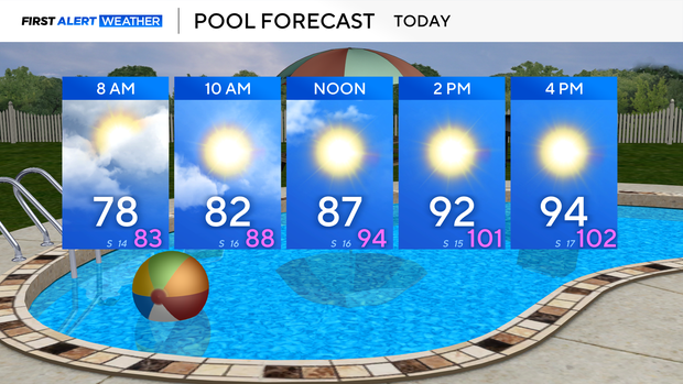
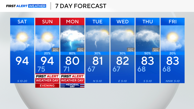
The day starts warm and humid with temperatures in the upper 70s.
Morning clouds will clear for afternoon sunshine with temperatures in the mid-90s.
A breezy southerly wind won't do much to keep you cool as it feels like temperatures near 100.
Very similar conditions are expected Sunday with partly cloudy skies and highs, once again, in the mid-90s.
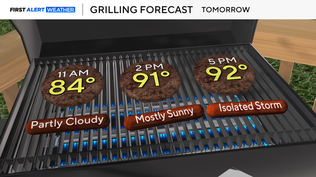
If you are grilling for lunch, you don't have to worry about any storms, but by the evening, a few storms will begin to bubble up in North Texas.
Sunday evening into Monday will be First Alert Weather Days as storms move in from the northwest, making for a bumpy end to the holiday weekend.
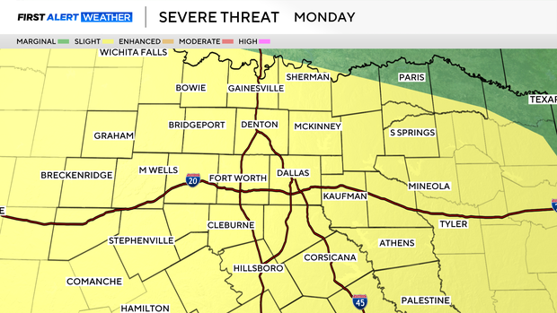
The severe threat increases for our northwest areas around sunset Sunday and expands to include all of North Texas on Memorial Day.
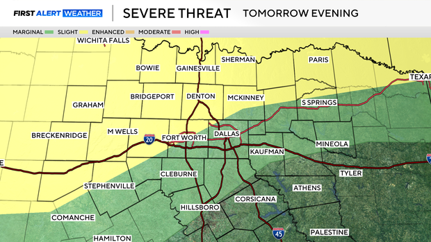
The main threats are large hail, damaging winds, and heavy rain with localized flooding. But the tornado threat is not zero.
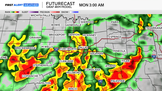
Storms will increase in coverage overnight Sunday into Monday morning.
Current model trends have a break in precipitation during the midday hours before another round develops in the afternoon.
Please remain weather aware and have multiple ways to get warnings.
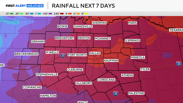
This is the start of an unsettled pattern that runs through next week. Some areas could see nearly 3" of rain by Friday.
The benefit of the clouds and storms is cooler temperatures with highs staying in the lower 80s for most of next week.
Have a safe weekend!