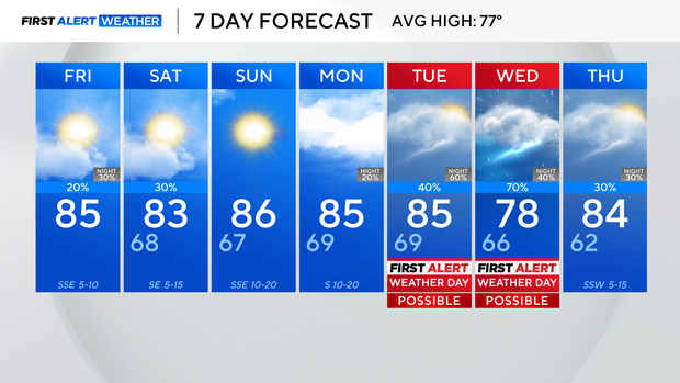
Most of Dallas, Fort Worth area will get a break from the rain through the weekend

After two days of rainy weather in North Texas, most of the region will dry out Friday and through the weekend.
There is a slight chance for isolated showers or storms on Friday. The best chance for rain will be Friday afternoon or evening, mainly in the southern counties of North Texas.
The lull in precipitation will allow temperatures to climb well into the 80s Friday afternoon, so it will feel warm outside.
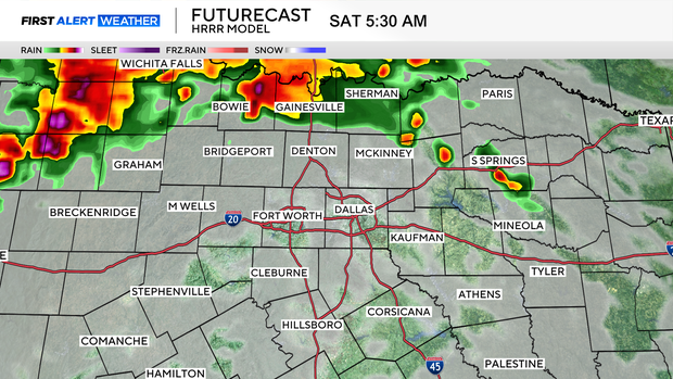
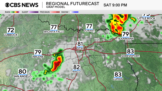
Another complex of storms is expected to graze portions of North Texas on Saturday. While the storm systems appear to be weakening as they approach the region, the atmosphere is unstable so there will still be a low-end potential for strong to severe wind gusts.
The First Alert weather team is also watching for the development of another storm cluster in the Texas Panhandle, which could move toward North Texas by late Saturday night. That said, it's still uncertain whether this cluster will hold together or weaken first. For now, rain chances are low (20–30%) Saturday night to reflect that possibility.
Looking ahead, Sunday and most of Monday will be rain-free, but don't get too comfortable – the quiet stretch looks short-lived. Starting late Monday, showers and storms develop may to the west as a disturbance moves into West Texas. The main factor that could limit storm development at that point is the presence of a cap, which might prevent thunderstorms.
On Tuesday, another round of storms is expected ahead of a cold front moving into the Southern Plains, which looks to stall out near the Red River. Then on Wednesday, the atmosphere is setting up for the possibility of more showers and storms.
With warm temperatures from Monday through Wednesday, there will likely be a risk for severe weather each day. It's still too early to nail down exact threat areas or specific hazards, but the First Alert Weather will team be watching it to make sure North Texas is prepared.
A cold front looks to be headed for the region late next week which could bring additional rain and storm chances, but forecast models are not agreeing yet on the exact timing and intensity.