Cold front brings chilly temps, drizzle to North Texas this Super Bowl Sunday

NORTH TEXAS — Summer felt like just yesterday with a high of 88°.
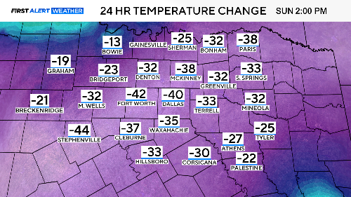
The metroplex experienced a 40-degree drop from Saturday afternoon to Super Bowl Sunday.
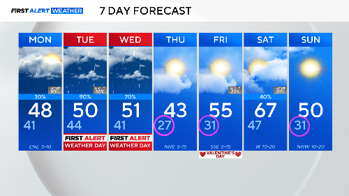
It has been a cloudy, drizzly Sunday. We'll have a few showers around on Monday along with morning drizzle and patchy fog. This will not be a washout, just a dreary day.
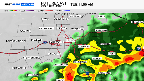
First Alert Weather Days have been called for Tuesday and Wednesday as two waves of rain move over us.
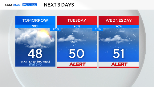
The rain picks up on Tuesday morning. A few storms and some lightning are expected but not severe weather. Do expect ponding on the roads and a slow commute Tuesday morning.
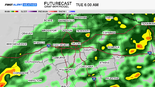
This first wave peaks in the first half of the day, and only slight chances of rain will hang on across the evening commute.
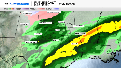
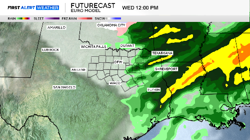
The next wave is overhead for the Wednesday morning commute. It should also depart to the east by afternoon.
Saturday was an aberration, in our 126-year weather history, there have only been 10 days in February warmer than Saturday. Not only is winter back, but we are also expecting some freezing mornings. On Thursday morning, wind chills could dip down to the low teens.
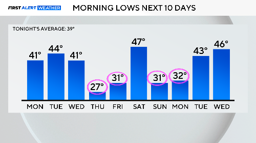
Below is the 7-day forecast. It tries to warm up again on Saturday, but another cold front comes in to remind us the calendar still says February.