Cold front turns nice spring day into chilly evening in North Texas
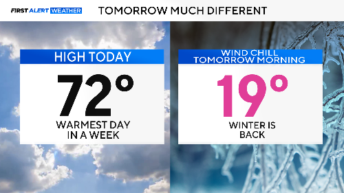
NORTH TEXAS – Spring was just a few hours ago. Then, strong north winds with gusts over 40 mph behind a cold front pushed the temperatures back down to winter levels.

Get ready for wind chills in the teens tomorrow morning, with highs only reaching the 40s.
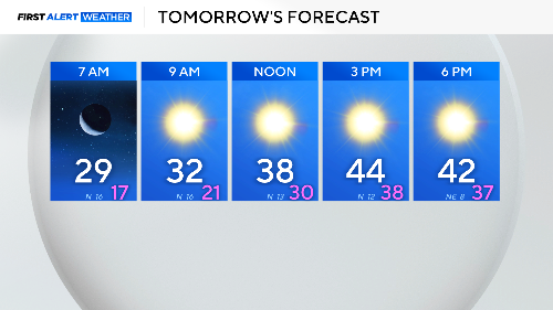
What a shock to the system. Tomorrow morning will feel like a whole different season compared to this afternoon.
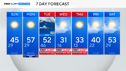
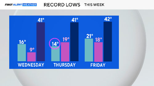
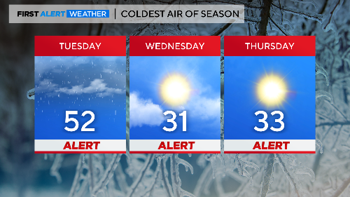
Just wait. By midweek, we are expecting the coldest air in over a year. We started February with record highs, and now we are talking about record lows.
We are expecting cold rain on Tuesday along with gusty winds. Temperatures will drop to the low 40s by the end of the day. By evening, that rain could become freezing rain, and bridges and overpasses could get a thin coating of ice.
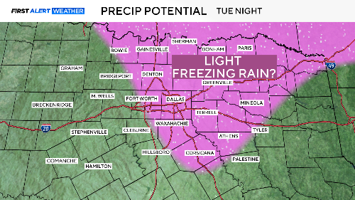
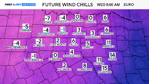
Right now, there is a low chance of a high-impact event, but we'll watch it carefully through the night. What there is a high chance of is dangerously low wind chills by Wednesday morning.
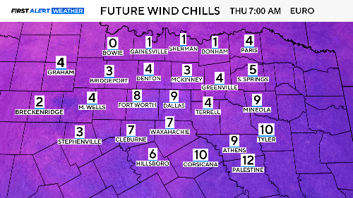
The same story for Thursday morning: very cold temperatures that could damage your skin and extremities if you're not careful.
This is the coldest air of the season. Highs will likely stay below freezing on Wednesday and only briefly rise above freezing on Thursday. Make sure to protect your pipes and pets!
We'll climb out of this chill by the end of next weekend. Until then, stay posted to the latest forecasts from the First Alert Weather Team for the ice threat Tuesday night and the dangerous cold that follows. The start of spring is still 33 days away.