Bay Area set to be on extended flood watch when next storm arrives
SAN FRANCISCO -- A flood watch for the Bay Area goes into effect early Saturday morning and extend into Tuesday afternoon as the region gets pounded by the first of two atmospheric rivers.
The anticipated rain is expected to cause more damage from flooding and falling trees as Northern California gets another round of soaking.
The flood watch will start at 4 a.m. Saturday morning and remain in effect until 4 p.m. Tuesday afternoon, according to weather officials.
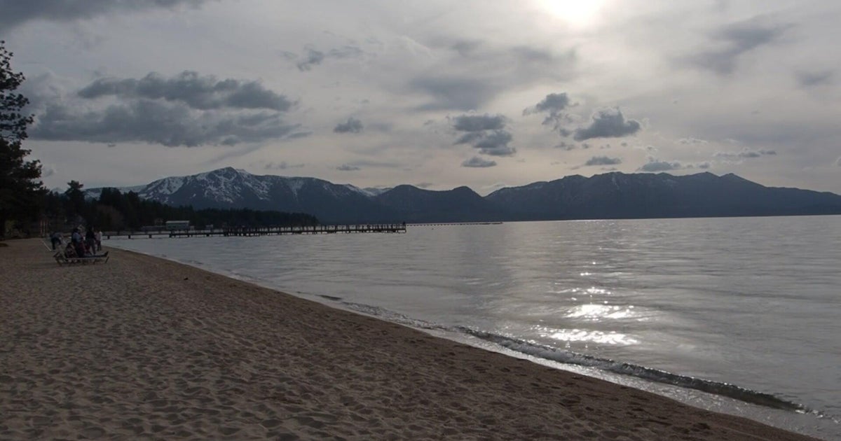
The flood watch covers most of the region, stretching from the North Bay through the San Francisco Bay shoreline and Peninsula Coast, the Santa Clara Valley including San Jose and Santa Cruz Mountains south to Monterey County and inland to the East Bay hills and interior valleys and eastern Santa Clara hills.
The next storm system will bring heavier rain to the Bay Area and Central Coast early Saturday morning through Sunday, according to the National Weather Service. Rainfall totals over the weekend will generally be in 1-2 inch range, though parts of the North Bay and the coastal mountains will see 2-4 inches. The wettest peaks of the North Bay could see up to 6 inches of rain.
The more potent atmospheric river will bring heavy rain early Monday through Tuesday. Rainfall totals for that system will generally be 2-4 inches across much of the region in the lower elevations with 3-6 inches in the North Bay and coastal mountains. The wettest peaks of the North Bay and the Santa Cruz Mountains could see up to 10 inches of rain.
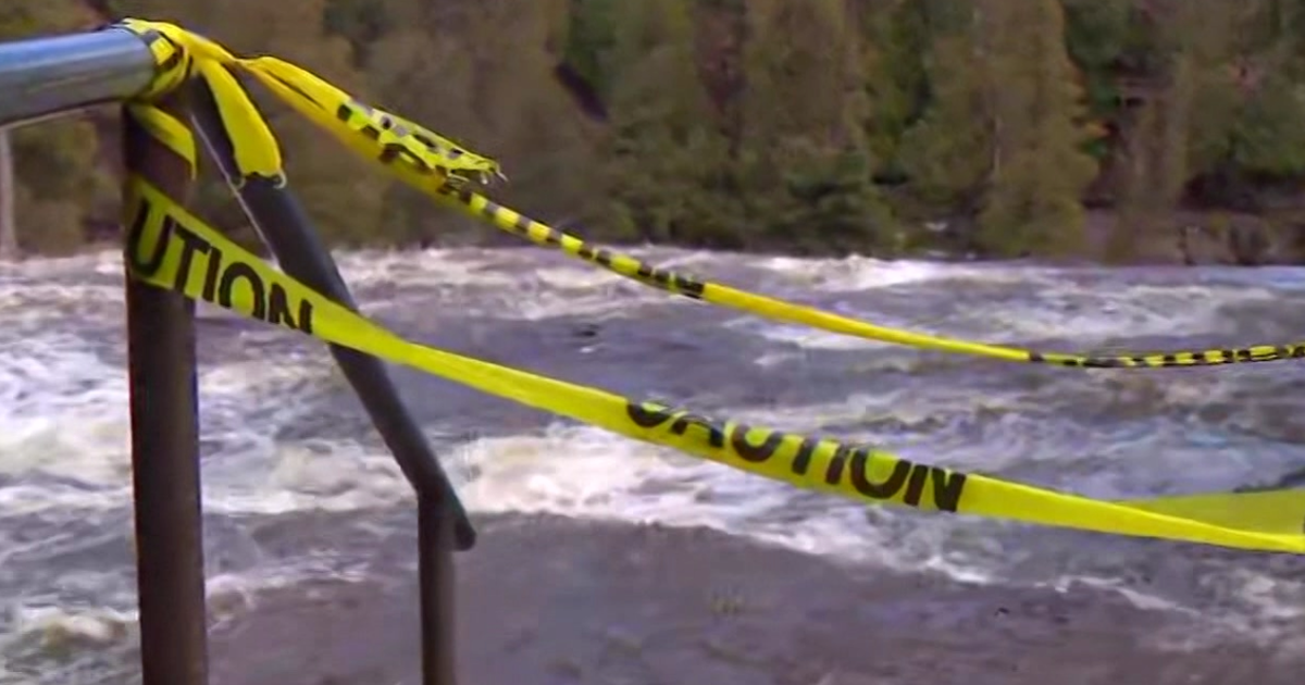
Given the saturated soils and recent rains, Bay Area residents can expect rapid responses on all streams and creeks with quick rises on the mainstem rivers, resulting in widespread flooding. Flooding is most likely Monday and Tuesday. The second system will likely result in an increased risk of mudslides and debris flows across the region.
There is also a wind advisory that will go into effect over the weekend. The North Bay will see stronger winds starting early Saturday morning that are forecast to continue through Sunday at 1 p.m. For the rest of the Bay Area and the Central Coast, the wind advisory goes into effect at 10 a.m.
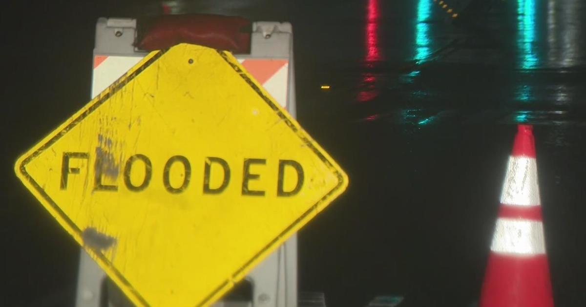
California weather calmed Friday, but the lull was expected to be brief as more Pacific storms lined up to blast into the state, where successive powerful weather systems have knocked out power to thousands, battered the coastline, flooded streets, toppled trees and caused at least six deaths.
Remnant showers from the latest storm, a "bomb cyclone," fell around the state and dangerous surf pounded the coast despite declining wave heights, while some areas enjoyed sunshine.
Between 2 and 4 inches of rain doused much of the Bay Area Wednesday and Thursday, with rainfall totals as high as 5 inches at some higher elevations, according to the National Weather Service.
The region received the most rainfall from Skyline Boulevard along the Peninsula down to the Santa Cruz Mountains, according to data from the weather service's Bay Area office, with up to 5 inches in some areas.
Higher elevations throughout the North Bay also received upwards of 3 and 4 inches of rain, with measurement sites in Angwin in Napa County receiving 4.04 inches and St. Helena receiving 4.32 inches.
Rainfall at most measurement sites in the East Bay sat between 2.5 and 3 inches while San Francisco received 1.33 inches, according to the weather service.
The rain and high winds, witch gusts reaching as high as 100 mph in some parts of the Bay Area, caused power outages for nearly half a million customers, according to PG&E. Heavy snow was forecast for the Sierra Nevada.
"A very active weather pattern across the Pacific Ocean will continue to push energetic and fast-moving low pressure systems toward the West Coast," the National Weather Service said. "California continues to take the brunt of the heavy precipitation and strong winds associated with these systems as we head into the first full weekend of 2023."
During the weekend, "the next moisture-laden Pacific cyclone is forecast to approach California with the next onslaught of heavy rain," the service said.
KPIX meteorologist Paul Heggen said there is yet another storm likely to arrive on Thursday.
The storms are atmospheric rivers, long plumes of moisture stretching far out into the Pacific, and capable of dropping staggering amounts of rain and snow.
Downtown San Francisco had its wettest 10-day period since 1871 between Dec. 26 and Jan. 4 when 10.33 inches (26.24 centimeters) of rain fell. The all-time 10-day record was 14.37 inches (36.5 cm) in January 1862.
The storms have also been piling up much-needed snow in the drought-stricken state's mountains, where the snowpack supplies about a third of California's water supply.
"It has been a deep week with almost 5 FEET of snow (57.9 inches, 147 cm) falling in the last 7 days!" the UC Berkeley Central Sierra Snow Lab tweeted Friday.
The statewide snowpack was 191% of normal to date and 76% of the April 1 average, which is usually the peak, according to the California Department of Water Resources.
Storms have been arriving in California since early November. A powerful New Year's weekend storm that caused extensive flooding in Northern California's Sacramento County and four deaths was followed on Wednesday and Thursday by a "bomb cyclone," a shorthand reference to a storm intensified by a rapid plunge in air pressure through a process called bombogenesis.
Two deaths were reported, including a 2-year-old boy killed when a redwood fell on a mobile home.
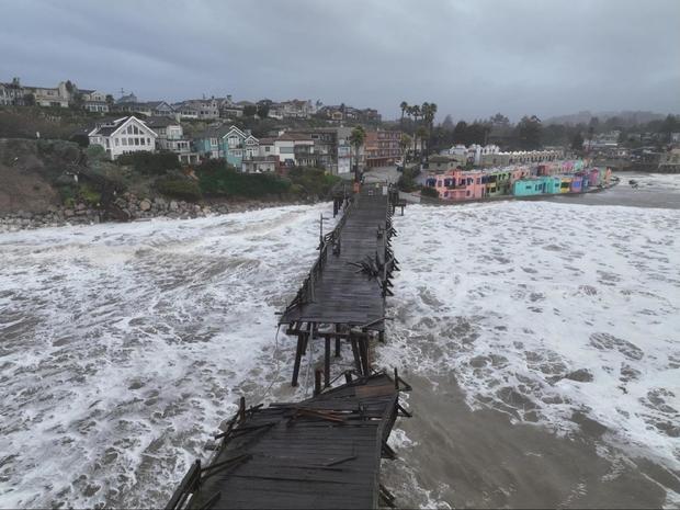
The seaside village of Capitola in Santa Cruz County about 60 miles (100 kilometers) south of San Francisco suffered possibly the worst damage as waves that were forecast to top 25 feet (7.6 meters) crashed into homes and restaurants at the mouth of Soquel Creek and knocked out a section of its historic wooden pier.
Hurricane-strength gusts as high as 101 mph (162 kph) toppled trees onto buildings and roads, knocked out power lines and blew down the roof on a gas station in South San Francisco.
National Weather Service meteorologist Warren Blier said the wind speed recorded on a Marin County hilltop was among the highest he could recall in a 25-year career.
The storms won't be enough to officially end the state's ongoing drought, now entering its fourth year, but they have helped. Not including the latest deluge, recent storms moved parts of the state out of the "exceptional drought" category in the U.S. Drought Monitor. Most of the state, though, remains in the extreme or severe drought categories.