Pittsburgh Weather: A Warm Wednesday Before A Couple Days Of Rain
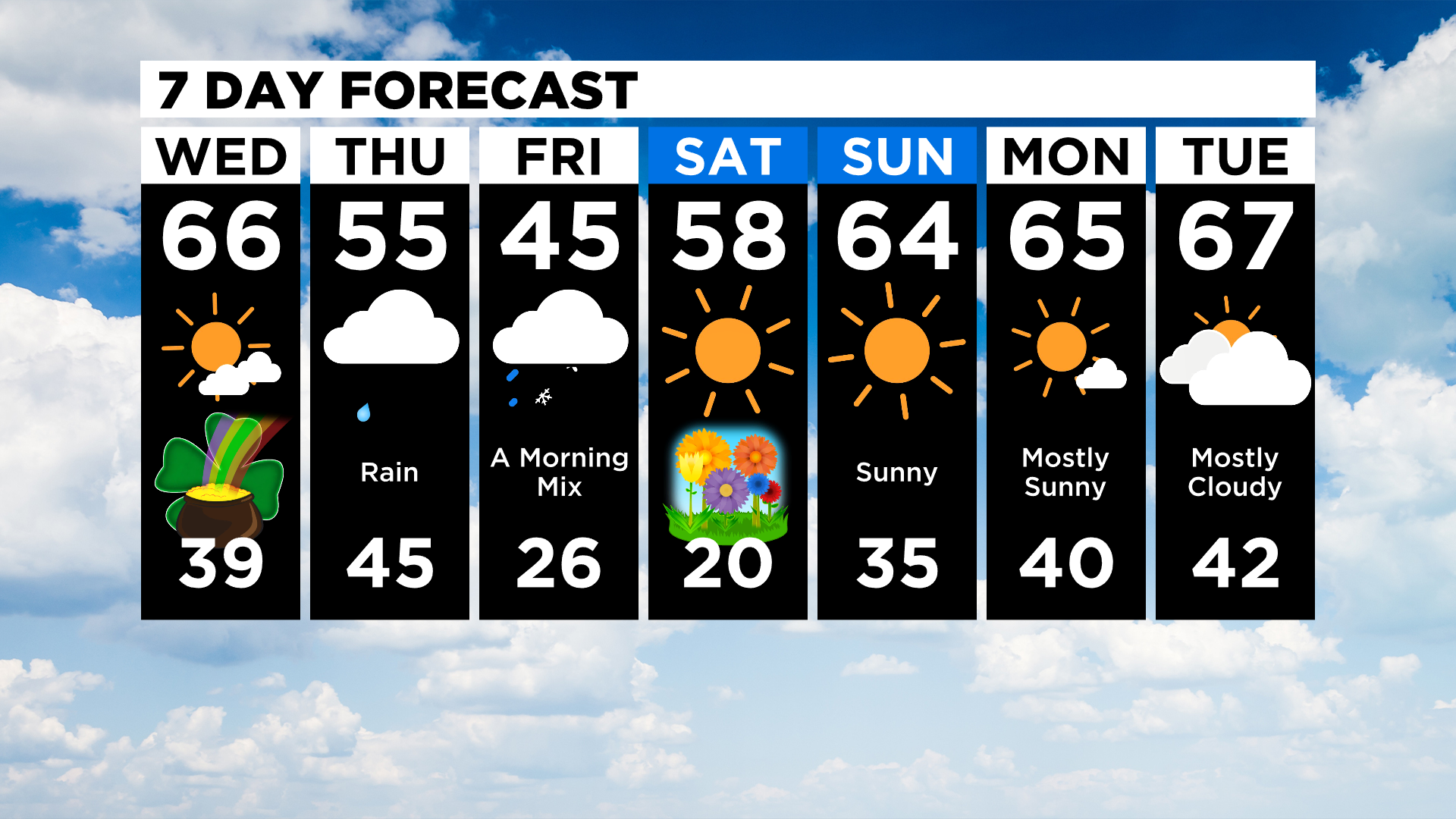
PITTSBURGH (KDKA) - Good morning, a nice warm day is expected across western Pennsylvania with highs well into the 60s.
Skies will be partly cloudy with the best chance for sunshine coming in the morning hours and clouds rolling back in from the southwest as soon as 3:00 p.m.
WEATHER LINKS:
Current Conditions | School Delays & Closings | Local Radar | Weather App | Photos
By 6:00 p.m. the entire area should be dealing with overcast skies.
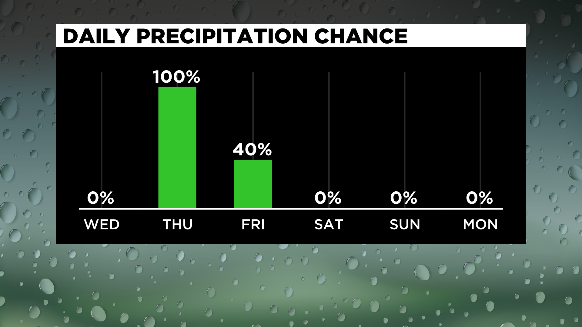
Things begin to change around midnight with the arrival of rain showers from the south.
Expect a rainy day on Thursday, with most places seeing about an inch of rain. Rain totals will be highest south of the state line into West Virginia, where totals could average around an inch and a half for the day.
The precipitation comes to an end early Friday morning with a brief round of snow tracking in from the north alongside colder air.
The weekend is looking dry and warmer though with highs both Saturday and Sunday near 60.
I do want to briefly mention the dangerous weather to the south setting up today, with long-track tornadoes possible for some communities.
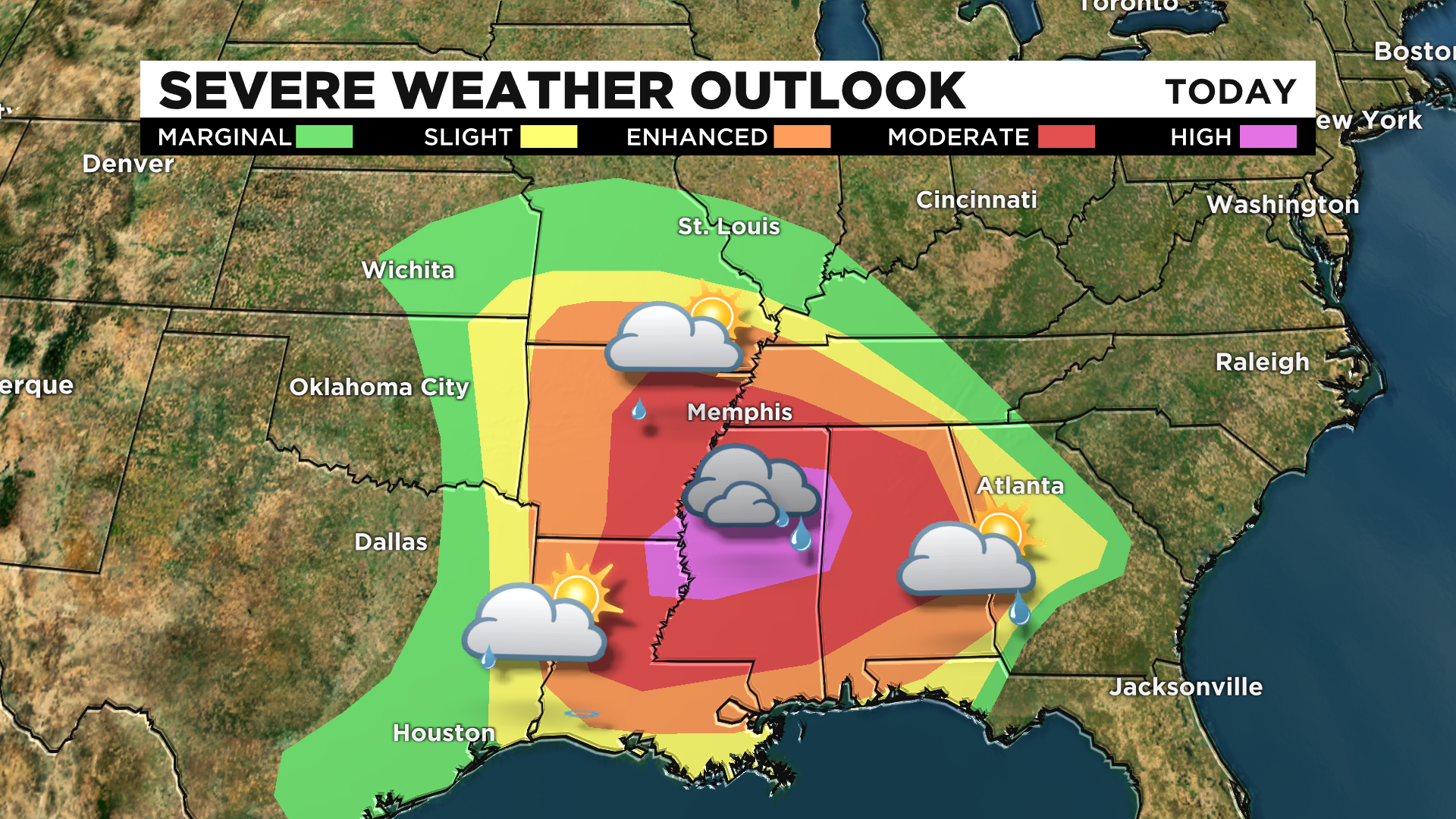
A fairly rare "high-risk" area has been forecast by the Storm Prediction Center with the highest chances for destructive and deadly tornadoes centered around Jackson, Mississippi.
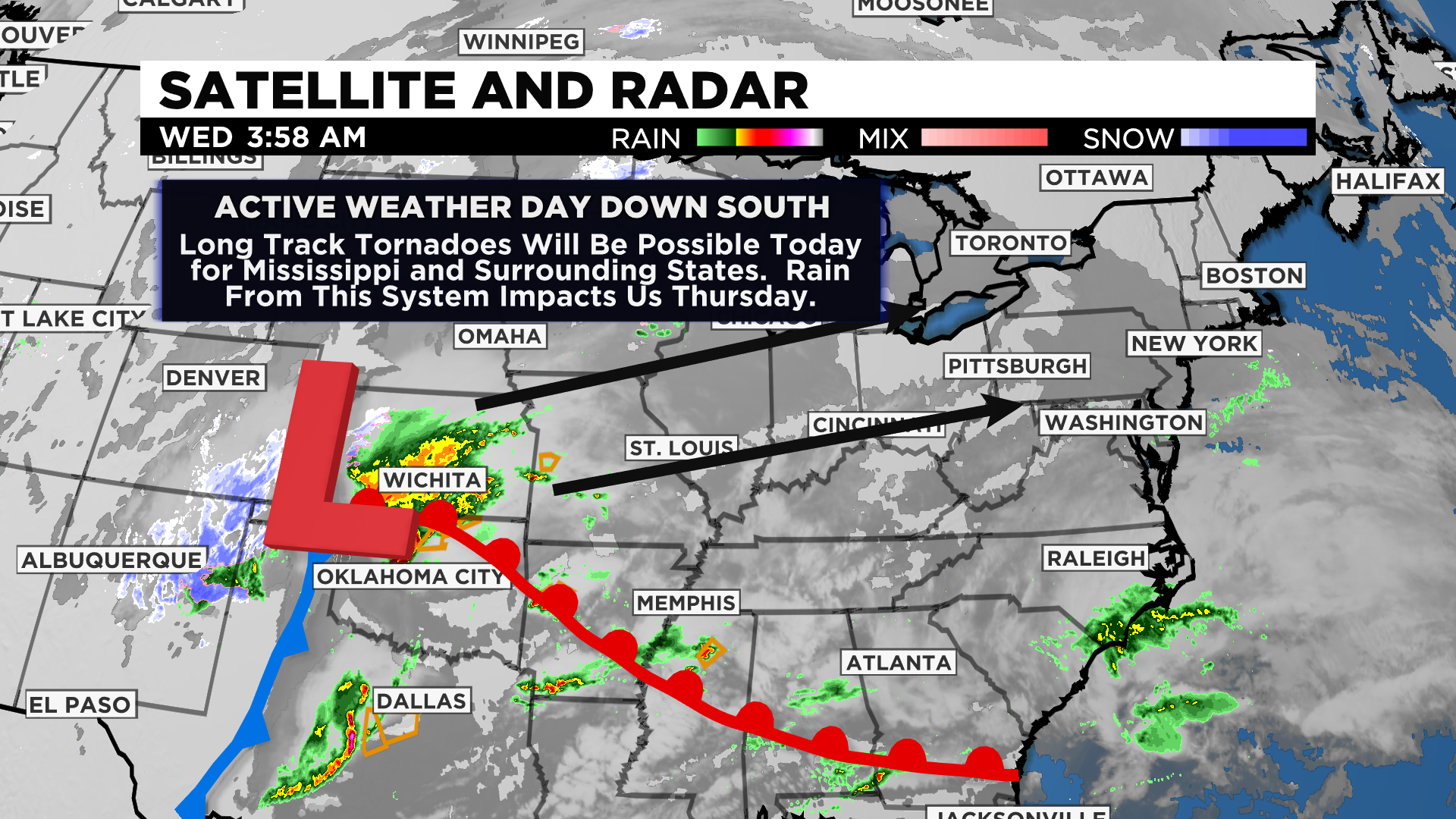
If you are heading south today please remain weather aware with severe weather being possible from Texas to Georgia.
Just a couple of quick hits: Today and yesterday both saw a near-perfect split of 12-hour day-night cycles. Spring officially begins this Saturday at 5:37 a.m.
Our average high-temperature today is 50 degrees, ending our annual stretch of 141 days.
Stay up to date with the KDKA app, which you can download here.