Storms, humidity return to the Philadelphia region Wednesday. Here's the weather forecast.
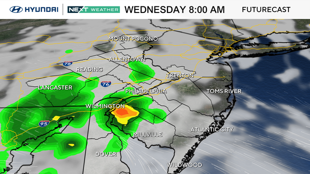
Pop-up showers and storms are likely throughout Wednesday in the Philadelphia region, so keep the umbrella handy.
While widespread severe weather is not expected, areas of moderate to heavy rain are, so be sure to be prepared if you are heading out.
In addition, add extra hairspray, as humidity levels will jump dramatically once the warm front pushes through the region.
NEXT big weather changes
The next big change comes in three forms: heat, humidity and storm risks.
Thursday through the weekend will feature daily chances for scattered showers and thunderstorms, mainly during the afternoon and evening.
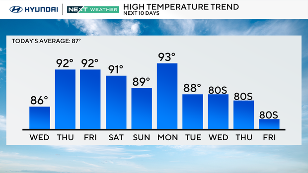
It will not rain all day or everywhere each day, but outdoor plans may need some flexibility as the unsettled summer pattern continues. It's looking like a heat wave may begin Thursday with highs in the low 90s each day through the weekend.
In addition, the humidity levels will skyrocket with dewpoint temps in the mid-upper 70s for most of the remainder of the week. Get ready to sweat, big time, if you are going to be outdoors. Highs in the low 90s will feel like the triple digits.
Here's your 7-day forecast:
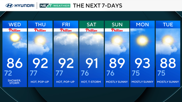
Wednesday: Shower, storm. High 86, Low 72
Thursday: Hot, pop-up storm. High 92, Low 77
Friday: Hot, pop-up storm. High 92, Low 77
Saturday: Hot, thunderstorm. High 91, Low 76
Sunday: Mostly sunny. High 89, Low 76
Monday: Mostly sunny. High 93, Low 75
Tuesday: Mostly sunny. High 88, Low 75


