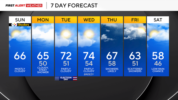
The week begins with clouds and mild temperatures before rain chances return to Pittsburgh

Waves of mid- and high-level cloud cover will continue to spread across western Pennsylvania today, tonight, and Monday in advance of the first of two disturbances expected to move through our area this week.
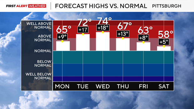
Highs will reach the low to mid 60s area-wide today, which is several degrees above normal considering we are now in the month of November.
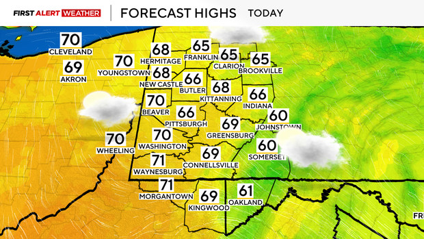
Winds will be light out of the southeast around 5-10 mph.
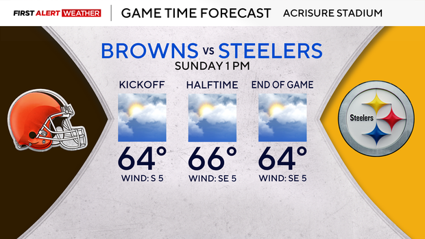
A weak disturbance currently passing over the mid-Mississippi River Valley will move across western Pennsylvania during the day on Monday. While moisture will be limited, some of our model guidance does indicate this system may be strong enough to induce a few very light rain showers.
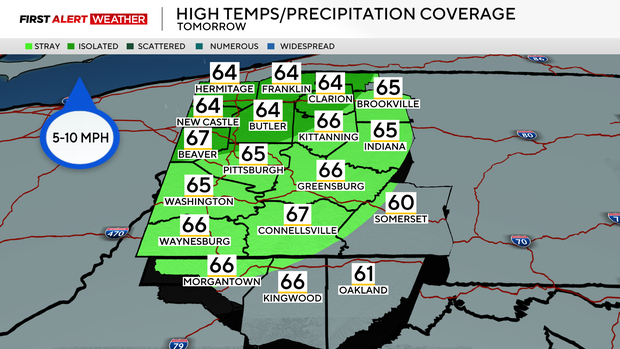
As of now, the higher probability of seeing a passing light rain shower will be over the northwest half of our forecast area where slightly higher values of atmospheric moisture will be present. Skies will be mostly cloudy to overcast on Monday, and we will see another day of mid-60s for highs.
As drier air moves in and an upper-level high-pressure ridge expands on Tuesday, there will be less cloud cover and daytime highs will also be much warmer. Highs area-wide will reach the low-mid 70s Tuesday and Wednesday afternoons.
With winds aloft increasing and warmer daytime highs, it will also be breezier, with south winds gusting up to 20-25 mph on Wednesday.
The second disturbance of the week arrives Wednesday night into Thursday, forcing a cold front to move across the region with a line of moderate rainfall. Limited instability should keep the potential for thunder low, but non-zero.
We may get a dry slot in the activity Thursday night into Friday morning, then another disturbance moving in from the west on Friday will likely trigger a few more showers. Temperatures will slowly drop next weekend, but likely still be near or slightly above normal.