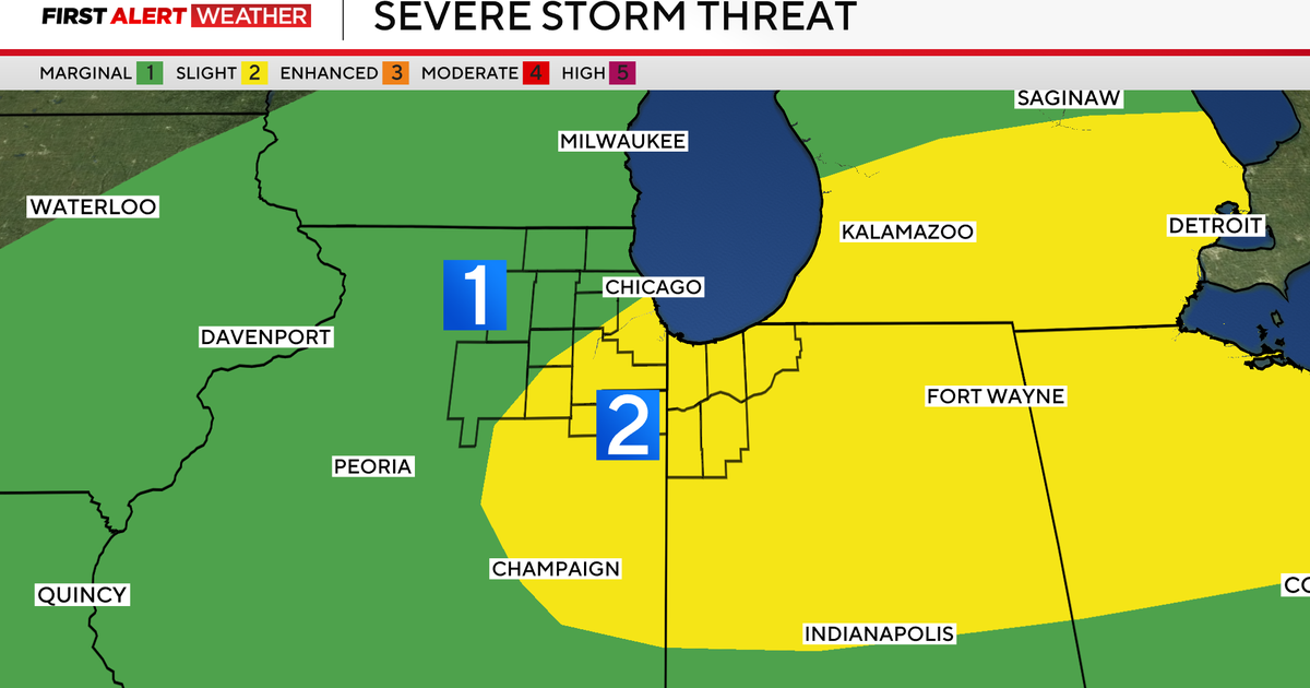
Storm damage in Butler County is from a tornado, National Weather Service says
The Pittsburgh office of the National Weather Service says damage in Butler County is from a tornado.
Storm surveyors will examine the damage on Thursday to determine the maximum wind speeds and the length and width of the tornado's path.
A tornado watch was in place for most of western Pennsylvania but has since expired. There were two tornado warnings: one for parts of Butler and Armstrong counties and another for Allegheny, Washington and Westmoreland counties. They've both since expired.
Flash flooding possible
Rain totals for Wednesday and Thursday will average more than an inch region wide, with some isolated communities potentially topping 2 inches. This will be enough to see at least some marginally high river and creek levels.
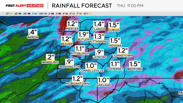
Flash flooding will also be possible after any heavy downpours, which will be frequent. The area started the day with its yearly rainfall around three-tenths of an inch behind the "average" pace. The area should be ahead of the pace by the end of the day.
Rain will continue through the overnight hours with a more consistent but lighter rain around.
Cooler temperatures moving in
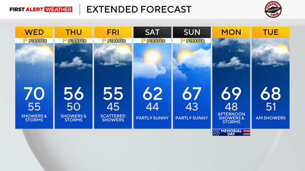
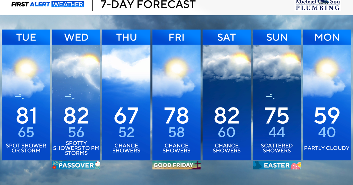
Looking at temperatures, the area will see highs near 70 degrees on Wednesday. It's the warmest day of the week.
Highs on Thursday and Friday are only expected to get into the mid-50s. Who's turning on their heaters? The Pittsburgh area is back in the 60s for highs on Saturday and Sunday. Afternoon storms will be possible on Memorial Day with highs near 70.