Pittsburgh Weather: Wind Chill Advisory For Regions North, East Of Pittsburgh
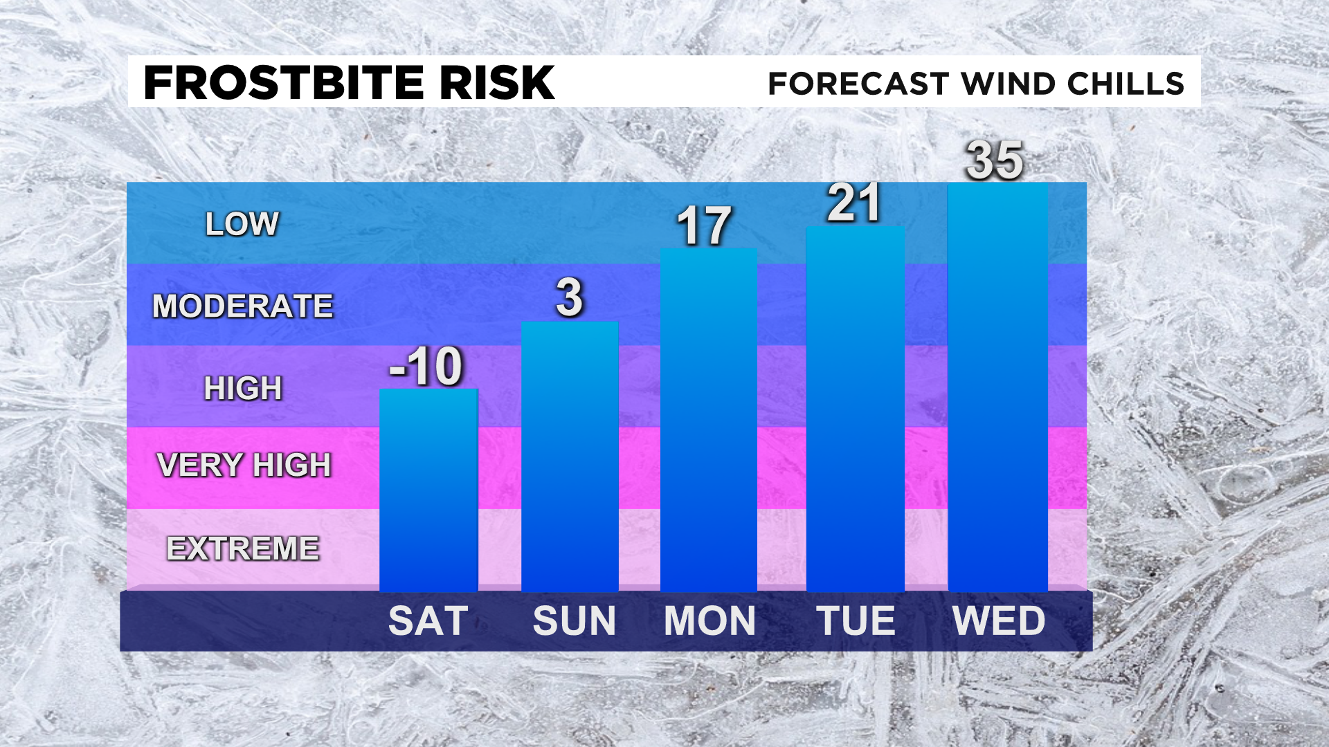
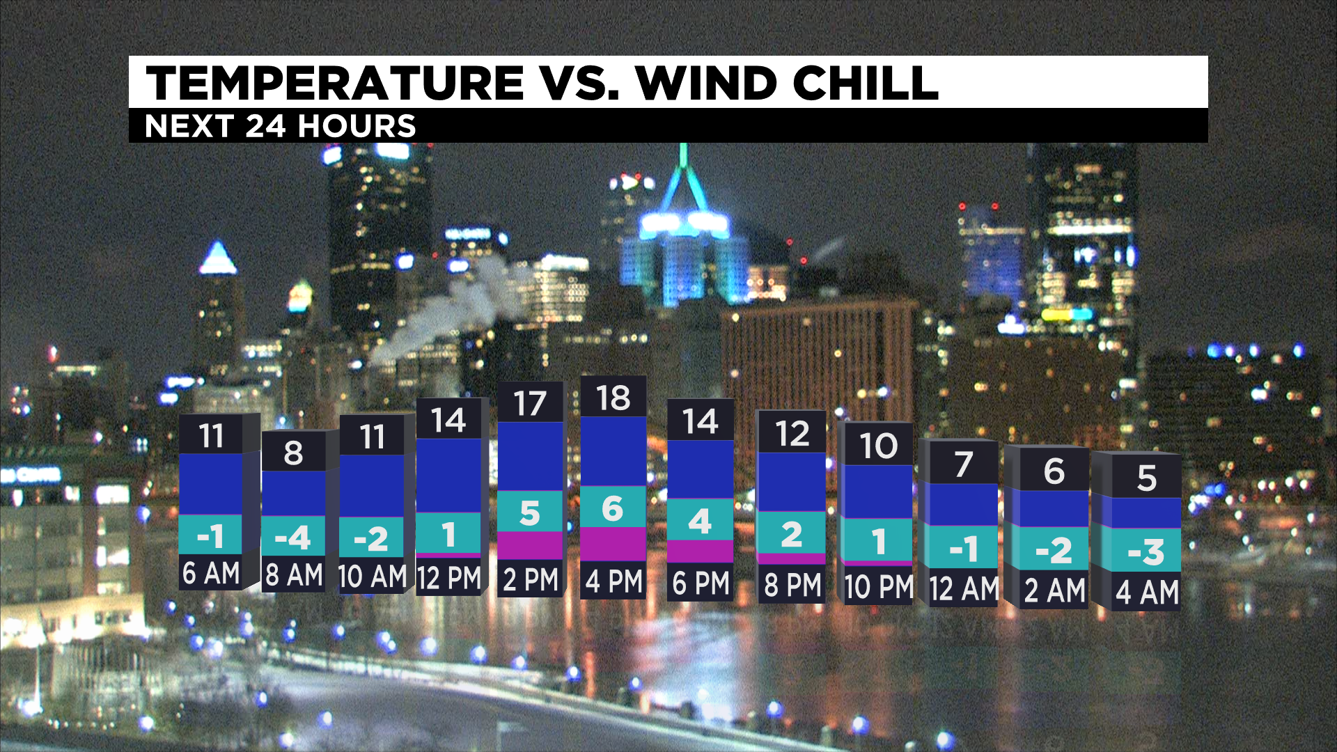
PITTSBURGH (KDKA) -- A Wind Chill Advisory for areas north and east go until 11 a.m. where values are as low as 15° below zero.
Even though we have a lot of sunshine today, highs will only be in the mid-teens.
WEATHER LINKS:
Current Conditions | School Delays & Closings | Local Radar | Weather App | Photos
Sunday morning will be the coldest of the week with lows back below zero as well as wind chills well below zero so be on alert for another Wind Chill Advisory. There's a few scattered snow showers possible Sunday with highs getting back to the mid 20s. 1-2" of snow is possible Sunday evening.

January is looking to end as the snowiest since 2011 with 19.2" of snow. In 2011 there was 24.1" and the snowiest was back in 1978 of 40.2". The normal for the month should be around 11.5".
After Sunday we are in for a thaw (finally). February is off to an above normal start with highs in the mid 40s starting Tuesday. January is ending well below normal by over 4°.

Wednesday and Thursday there's a chance for rain and a few snow showers but highs will be in the 50s and then back near 40 for the end of the week.