Pittsburgh Weather: Current Forecast Show Likelihood Of Heavy Snow In Region
PITTSBURGH (KDKA) -- It'll be clear and cold on Saturday night, with lows in the teens and even some single digits expected north near Interstate-80.
WEATHER LINKS
Current Conditions | School Delays & Closings | Local Radar | Weather App | Photos
Those clear skies will lead to some nice sunshine early Sunday before clouds roll in ahead of the winter storm system in the afternoon. The storm is getting its act together right now near Arkansas and is drawing moisture in from the Gulf of Mexico.
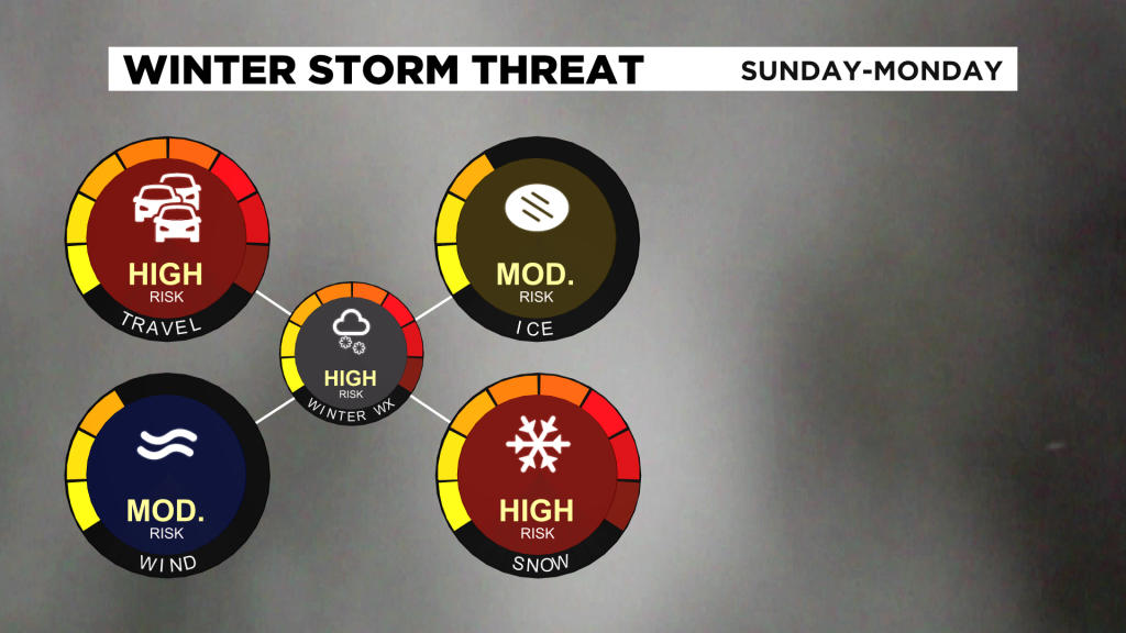
Easterly wind flow at the surface will allow chilly air to stay in place across our region. The current setup leads to a likelihood of heavy snow in southwestern Pennsylvania and the surrounding region Sunday night into early Monday morning.
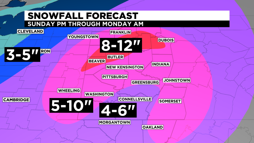
There is also a chance for warm air to allow a mix with changeover to freezing rain, rain or sleet for a period of time on Sunday evening, especially along and south of I-70. This could lower snow totals in those areas somewhat.
WATCH: More Weather Coverage
That will likely happen late Sunday evening, and there could even be a brief break in the precipitation as that dry slot nudges in for a while. Don't be fooled, there will be more snow to come overnight into Monday morning with cold air pushing into the area once again.
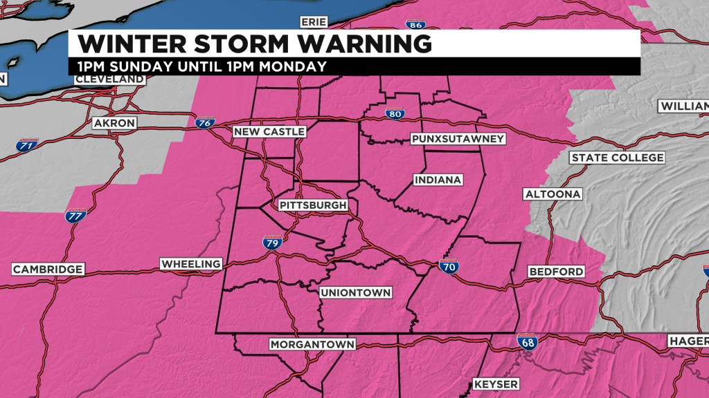
A winter storm warning begins Sunday at 1 p.m. for the entire region and will remain in place through 1 p.m. on Monday. Roads on Sunday night and Monday will be slick and snow-covered, making travel very difficult.