Severe storms with heavy winds, hail, and potential tornadoes possible in Pittsburgh | First Alert Weather

Severe storm chances remain in place for another day today, with storm chances peaking this afternoon into the evening hours.
Yesterday's storm chance started up around 1 p.m., and the strongest storms were moving out of our area by 7 p.m. Today's storm chance starts around 4 p.m. and goes through midnight. Similar to yesterday, strong winds are the main threat.
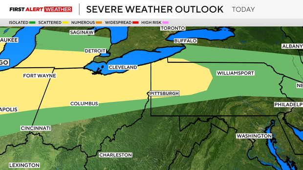
Large hail and even tornadoes can't be ruled out.
The reason for the storms today is due to a boundary and the jet stream parked right on top of us. The fast-moving jet stream is causing lift at the surface. This, along with warm temperatures and low humidity levels sitting over much drier and cooler temperatures, creates conditional instability. Any trigger that rolls through (cold front, outflow boundaries, remnants from yesterday's storms) will be enough to trigger storm development.
Model data continues to show a line of showers stretching from the east to the west, developing this afternoon to the north of Pittsburgh. While this is where the highest chance for rain will be, storms could develop off of this line, impacting other places around Western Pennsylvania.
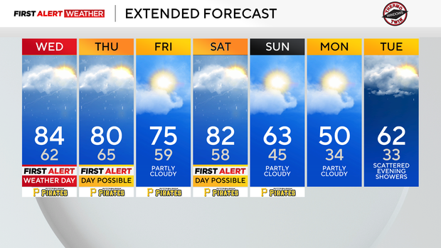
The general setup will stick around through Saturday. Storm chances will be around on Thursday. It looks like we get a break from severe weather on Friday, with severe weather chances back on Saturday. In fact, Saturday's storm chance will likely be the highest all week long.
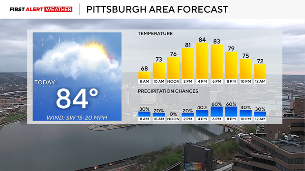
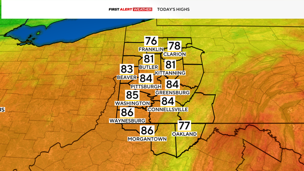
Back to today, high temperatures will hit the mid-80s. Pittsburgh's record high for today is 85°. I have Pittsburgh seeing a high of 84°. Noon temperatures will be near 80 degrees.
Skies will be partly cloudy with winds out of the southwest at around 10 mph. Similar to earlier this week, winds will be breezy.
Looking ahead, we stay unseasonably warm through Saturday with temperatures falling to just slightly above average for the middle of next week.