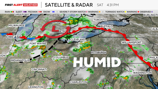
Storms rolling through Pittsburgh area bring flooding concerns
Another round of thunderstorms has developed this evening and will carry on into tonight. The storms that develop could bring some rather heavy rain at times.
The severity of the rain has caused several area roadways and businesses to flood, especially throughout Washington County, according to the National Weather Service.
The areas of impact include south of the city of Washington near the Washington County Airport.
Drivers are urged to avoid the area. Residents in this area are urged to seek higher ground.
Full forecast below.
Average High/Low: 83°/64°
Sunset/Sunrise: 8:41 p.m. / 6:14 a.m.
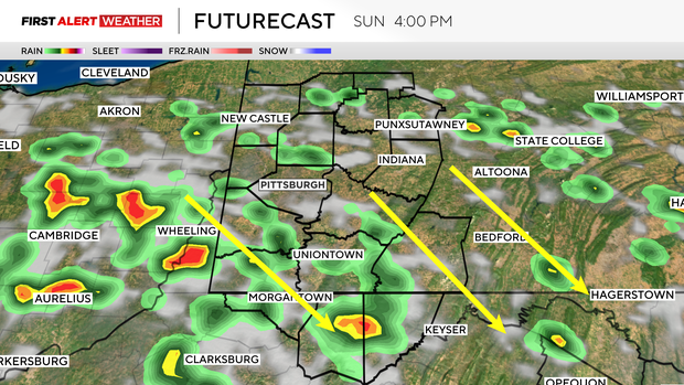
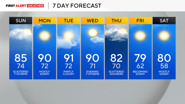
The atmosphere looks to remain unsettled again Sunday, especially during the afternoon with the passage of a disturbance. This will touch off additional storms. While there is the small chance a storm or two will become gusty, the risk of severe storms will be isolated. Temperatures Sunday will only reach into the mid 80s, but humidity levels will remain awful!
While drier conditions take over Monday and Tuesday, it will be hot again with relentless humidity. Today, we hit 90° for the tenth time in 2025. For reference, an average year sees 10 days at or above 90°.
This year is likely going to be above average in that category, as there is the potential for three more 90°+ days next week. Monday, Tuesday and Wednesday bring that big heat.
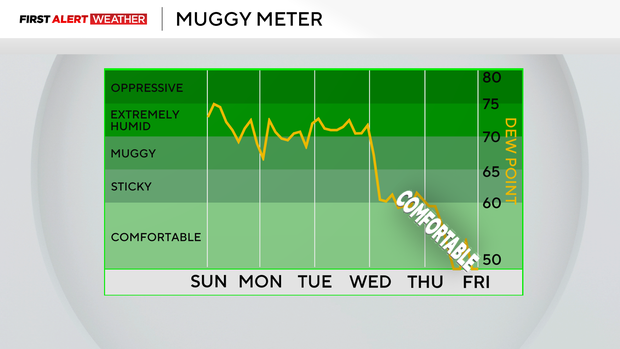
The weather will become much more comfortable after some Thursday thunderstorms. High temperatures will top off in the upper 70s and low 80s to end the week. Not only will it be cooler, but we can say "goodbye" to the exceptionally high humidity levels for a bit, too. To compliment the nicer feeling conditions, there should be plenty of sunshine, too.
WEATHER LINKS:
Current Conditions | School Closings & Delays | Submit Your Weather Photos