It's looking like a dry week ahead for the Pittsburgh area

It's looking like a dry week ahead for the Pittsburgh area.
Any Alert Days Ahead? Nope
Aware: The next rain chance comes on Sunday.
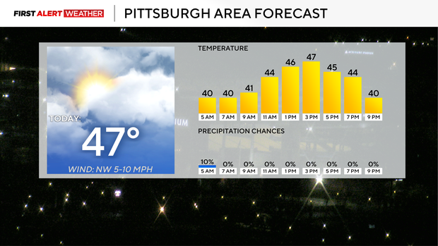
We won't see any pictures of a snow-covered Pittsburgh over the next week, with temperatures warming and our next precipitation chance occurring on Sunday. Highs today should hit the mid to upper 40s thanks to a fairly thick cloud deck. We will start to see sunshine poking through clouds after 3 this afternoon. I have Pittsburgh seeing a high temperature today of 47 degrees. Noon temperatures should be in the mid-40s. Winds will be out of the west-northwest at around 5 mph all day long.
I expect to see some fairly thick fog developing on Tuesday morning as warmer air begins to move in over saturated ground. Visibility will likely stay low through at least 9 a.m. if not later. As usual, low-lying areas and near moisture sources will see the thickest fog. Tuesday morning lows will be near 30°, so temperatures will be well below where they are this morning. I have highs hitting the low 50s on Tuesday with sunny afternoon skies.
A ridge of high pressure continues to build into our area as we head into the back half of the work week. As the center of the ridge moves to our east, this will allow our winds to come out of the southwest with a deep 'fetch' pulling in much warmer temperatures. Our 850 mb temperatures will go from around 1°C today to near 10°C on Saturday, according to the GFS model. The EURO shows a similar warm-up. This increase in temperatures will see us go from the upper 40s today to the mid-60s on Friday and Saturday for highs.
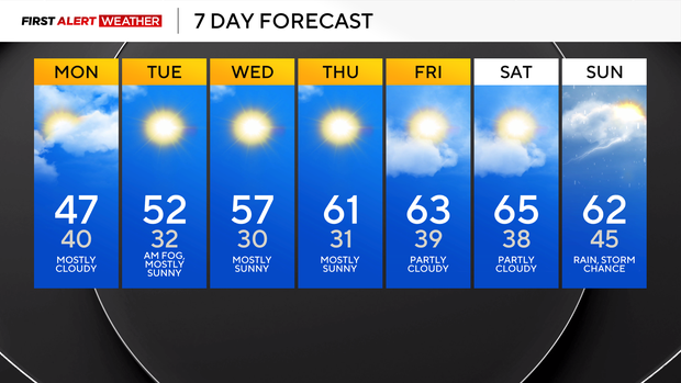
The cool front and our next rain chance come in on Sunday. Highs will dip to near 50 next Monday and Tuesday. Still warmer than today, though.